
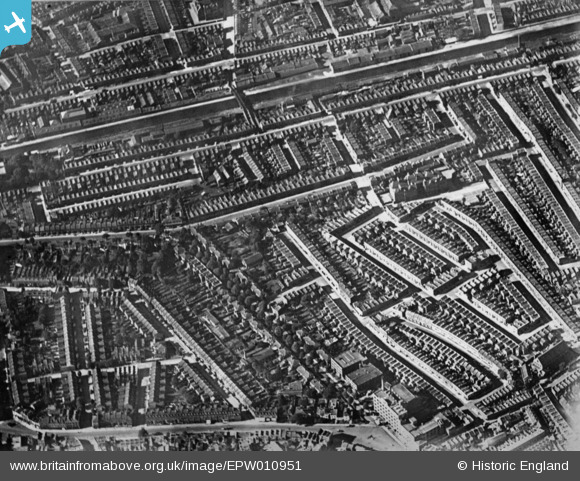
EPW010951 ENGLAND (1924). The residential area surrounding Blake's Road and Gloucester Grove, Camberwell, 1924. This image has been produced from a copy-negative.
© Hawlfraint cyfranwyr OpenStreetMap a thrwyddedwyd gan yr OpenStreetMap Foundation. 2026. Trwyddedir y gartograffeg fel CC BY-SA.
Delweddau cyfagos (2)
EPW010951

EAW000540

Manylion
| Pennawd | [EPW010951] The residential area surrounding Blake's Road and Gloucester Grove, Camberwell, 1924. This image has been produced from a copy-negative. |
| Cyfeirnod | EPW010951 |
| Dyddiad | June-1924 |
| Dolen | |
| Enw lle | CAMBERWELL |
| Plwyf | |
| Ardal | |
| Gwlad | ENGLAND |
| Dwyreiniad / Gogleddiad | 533353, 177446 |
| Hydred / Lledred | -0.079426128442268, 51.479744732993 |
| Cyfeirnod Grid Cenedlaethol | TQ334774 |
Pinnau
Byddwch y cyntaf i ychwanegu sylw at y ddelwedd hon!