
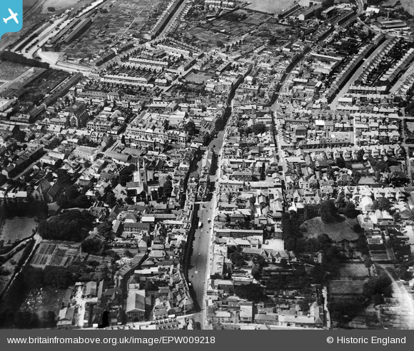
EPW009218 ENGLAND (1923). The High Street and environs, Ashford, 1923
© Hawlfraint cyfranwyr OpenStreetMap a thrwyddedwyd gan yr OpenStreetMap Foundation. 2026. Trwyddedir y gartograffeg fel CC BY-SA.
Delweddau cyfagos (14)
EPW009218

EPW026096

EPW026091

EPW026100

EPW009142

EPW000710

EPW026089

EPW001440

EPW026086

EPW007035

EPW009217

EAW026215

EPW041208

EAW013658

Manylion
| Pennawd | [EPW009218] The High Street and environs, Ashford, 1923 |
| Cyfeirnod | EPW009218 |
| Dyddiad | 1923 |
| Dolen | |
| Enw lle | ASHFORD |
| Plwyf | |
| Ardal | |
| Gwlad | ENGLAND |
| Dwyreiniad / Gogleddiad | 600996, 142808 |
| Hydred / Lledred | 0.87415558514664, 51.148660668776 |
| Cyfeirnod Grid Cenedlaethol | TR010428 |
Pinnau

Kent Navigator |
Wednesday 4th of October 2017 02:57:56 PM | |
|
Kent Navigator |
Wednesday 4th of October 2017 02:47:58 PM | |
|
Kent Navigator |
Wednesday 4th of October 2017 02:39:59 PM | |
|
Kent Navigator |
Wednesday 4th of October 2017 02:37:49 PM | |
|
Kent Navigator |
Wednesday 4th of October 2017 02:36:26 PM |