
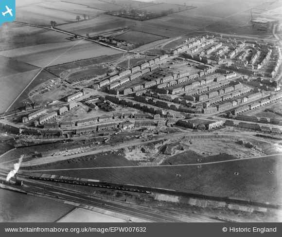
EPW007632 ENGLAND (1922). Mayfield Road and environs, Dagenham, 1922
© Hawlfraint cyfranwyr OpenStreetMap a thrwyddedwyd gan yr OpenStreetMap Foundation. 2026. Trwyddedir y gartograffeg fel CC BY-SA.
Delweddau cyfagos (4)
EPW007632

EPW007634

EPW006551

EPW007630

Manylion
| Pennawd | [EPW007632] Mayfield Road and environs, Dagenham, 1922 |
| Cyfeirnod | EPW007632 |
| Dyddiad | 23-March-1922 |
| Dolen | |
| Enw lle | DAGENHAM |
| Plwyf | |
| Ardal | |
| Gwlad | ENGLAND |
| Dwyreiniad / Gogleddiad | 547500, 187239 |
| Hydred / Lledred | 0.12827797472758, 51.564234924435 |
| Cyfeirnod Grid Cenedlaethol | TQ475872 |
Pinnau
Cyfraniadau Grŵp
Chadwell Heath, Mayfield Road area |

John |
Monday 2nd of July 2012 03:02:12 PM |
Dear John, That’s great; we’ve reviewed your comments and thanks to your help we can update the catalogue. The revised record will appear here in due course. Katy Whitaker Britain from Above Cataloguer |
Katy Whitaker |
Monday 2nd of July 2012 03:02:12 PM |
I don't know where it is but it clearly relates to photo; EPW007633. |
TheBlueCube |
Friday 29th of June 2012 09:51:06 AM |