
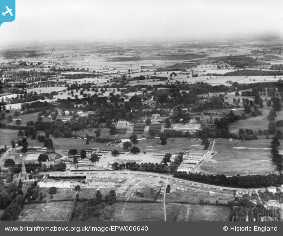
EPW006640 ENGLAND (1921). RAF Uxbridge and Hillingdon Court, Uxbridge, from the west, 1921. This image has been produced from a print.
© Hawlfraint cyfranwyr OpenStreetMap a thrwyddedwyd gan yr OpenStreetMap Foundation. 2026. Trwyddedir y gartograffeg fel CC BY-SA.
Delweddau cyfagos (3)
EPW006640

EPW041124

EPW041127

Manylion
| Pennawd | [EPW006640] RAF Uxbridge and Hillingdon Court, Uxbridge, from the west, 1921. This image has been produced from a print. |
| Cyfeirnod | EPW006640 |
| Dyddiad | June-1921 |
| Dolen | |
| Enw lle | UXBRIDGE |
| Plwyf | |
| Ardal | |
| Gwlad | ENGLAND |
| Dwyreiniad / Gogleddiad | 506081, 183586 |
| Hydred / Lledred | -0.47018479345821, 51.540712676767 |
| Cyfeirnod Grid Cenedlaethol | TQ061836 |
Pinnau

M |
Tuesday 24th of September 2024 01:22:00 AM |