
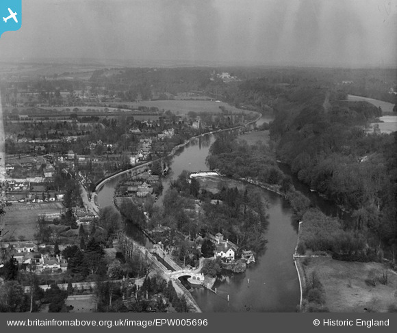
EPW005696 ENGLAND (1921). View over Maidenhead Court from Boulter's Lock and Ray Mill Island, Maidenhead, from the south, 1921
© Hawlfraint cyfranwyr OpenStreetMap a thrwyddedwyd gan yr OpenStreetMap Foundation. 2026. Trwyddedir y gartograffeg fel CC BY-SA.
Delweddau cyfagos (8)
EPW005696

EPW056585

EPW022723

EAW051193

EAW028018

EAW028019

EAW028017

EAW045408

Manylion
| Pennawd | [EPW005696] View over Maidenhead Court from Boulter's Lock and Ray Mill Island, Maidenhead, from the south, 1921 |
| Cyfeirnod | EPW005696 |
| Dyddiad | March-1921 |
| Dolen | |
| Enw lle | MAIDENHEAD |
| Plwyf | |
| Ardal | |
| Gwlad | ENGLAND |
| Dwyreiniad / Gogleddiad | 490349, 182581 |
| Hydred / Lledred | -0.69724849363326, 51.534415919256 |
| Cyfeirnod Grid Cenedlaethol | SU903826 |
Pinnau

misterjohn |
Sunday 1st of January 2023 04:39:43 PM | |
|
misterjohn |
Sunday 1st of January 2023 04:38:03 PM |