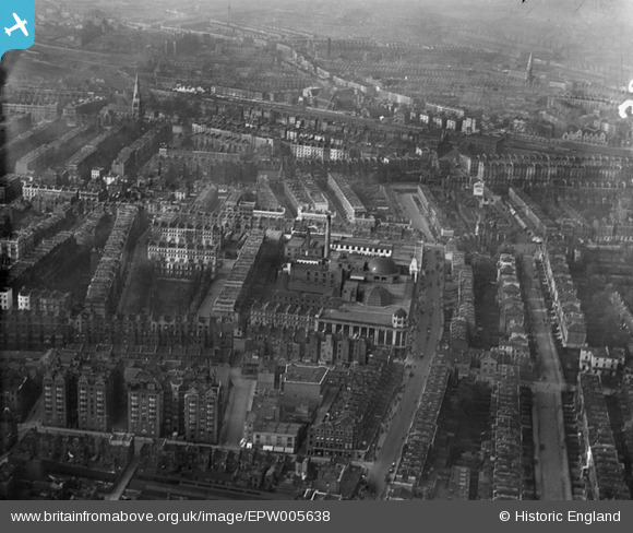
EPW005638 ENGLAND (1921). Whiteley's and the Kensington Gardens Square area, Bayswater, from the south-east, 1921
© Hawlfraint cyfranwyr OpenStreetMap a thrwyddedwyd gan yr OpenStreetMap Foundation. 2026. Trwyddedir y gartograffeg fel CC BY-SA.
Delweddau cyfagos (3)
EPW005638

EAW022141

EAW022135

Manylion
| Pennawd | [EPW005638] Whiteley's and the Kensington Gardens Square area, Bayswater, from the south-east, 1921 |
| Cyfeirnod | EPW005638 |
| Dyddiad | March-1921 |
| Dolen | |
| Enw lle | BAYSWATER |
| Plwyf | |
| Ardal | |
| Gwlad | ENGLAND |
| Dwyreiniad / Gogleddiad | 525799, 180971 |
| Hydred / Lledred | -0.18690292922715, 51.513158262164 |
| Cyfeirnod Grid Cenedlaethol | TQ258810 |
Pinnau

FitzG |
Monday 13th of April 2020 05:34:20 PM | |
|
TinyTim |
Sunday 16th of August 2015 07:52:46 PM | |
|
TinyTim |
Sunday 16th of August 2015 07:51:30 PM | |
|
TinyTim |
Sunday 16th of August 2015 07:49:07 PM | |

Class31 |
Tuesday 23rd of September 2014 10:20:50 PM |