
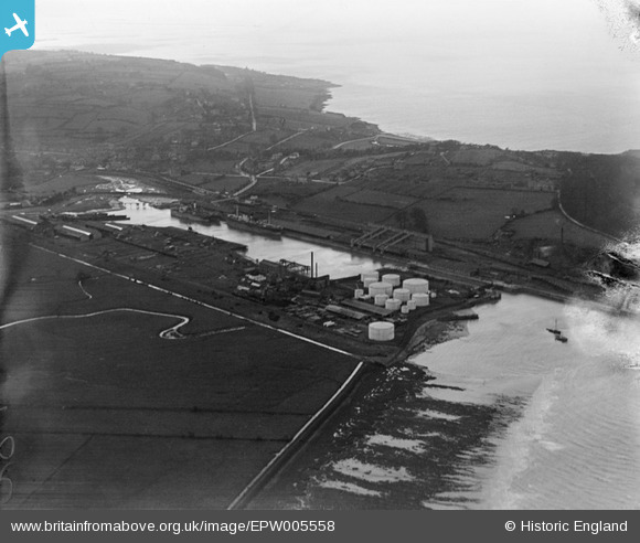
EPW005558 ENGLAND (1921). Portishead Dock, Portishead, from the east, 1921
© Hawlfraint cyfranwyr OpenStreetMap a thrwyddedwyd gan yr OpenStreetMap Foundation. 2026. Trwyddedir y gartograffeg fel CC BY-SA.
Delweddau cyfagos (3)
EPW005558

EPW008654

EPW005559

Manylion
| Pennawd | [EPW005558] Portishead Dock, Portishead, from the east, 1921 |
| Cyfeirnod | EPW005558 |
| Dyddiad | 20-March-1921 |
| Dolen | |
| Enw lle | PORTBURY WHARF |
| Plwyf | PORTBURY |
| Ardal | |
| Gwlad | ENGLAND |
| Dwyreiniad / Gogleddiad | 347840, 177166 |
| Hydred / Lledred | -2.7513685988795, 51.490547575036 |
| Cyfeirnod Grid Cenedlaethol | ST478772 |
