
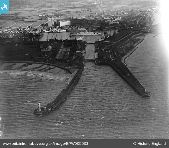
EPW005503 ENGLAND (1921). The North and South Piers and the Entrance Lock to The Royal Edward Dock, Avonmouth, 1921
© Hawlfraint cyfranwyr OpenStreetMap a thrwyddedwyd gan yr OpenStreetMap Foundation. 2026. Trwyddedir y gartograffeg fel CC BY-SA.
Delweddau cyfagos (8)
EPW005503

EPW005501

EPW005506

EAW002060

EPR000062

EPW005523

EPW022378

EAW002059

Manylion
| Pennawd | [EPW005503] The North and South Piers and the Entrance Lock to The Royal Edward Dock, Avonmouth, 1921 |
| Cyfeirnod | EPW005503 |
| Dyddiad | 20-March-1921 |
| Dolen | |
| Enw lle | AVONMOUTH |
| Plwyf | |
| Ardal | |
| Gwlad | ENGLAND |
| Dwyreiniad / Gogleddiad | 350506, 178839 |
| Hydred / Lledred | -2.7132027188223, 51.505830598464 |
| Cyfeirnod Grid Cenedlaethol | ST505788 |
Pinnau

Class31 |
Saturday 22nd of February 2014 08:05:52 PM |