
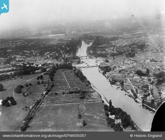
EPW005057 ENGLAND (1920). The River Thames at Hampton Wick and Kingston upon Thames, Kingston upon Thames, from the south, 1920
© Hawlfraint cyfranwyr OpenStreetMap a thrwyddedwyd gan yr OpenStreetMap Foundation. 2026. Trwyddedir y gartograffeg fel CC BY-SA.
Delweddau cyfagos (6)
EPW005057

EPW008869

EPW011000

EPW018089

EPW049590

EPW010999

Manylion
| Pennawd | [EPW005057] The River Thames at Hampton Wick and Kingston upon Thames, Kingston upon Thames, from the south, 1920 |
| Cyfeirnod | EPW005057 |
| Dyddiad | July-1920 |
| Dolen | |
| Enw lle | HAMPTON WICK |
| Plwyf | |
| Ardal | |
| Gwlad | ENGLAND |
| Dwyreiniad / Gogleddiad | 517611, 168936 |
| Hydred / Lledred | -0.30886020579412, 51.406744246572 |
| Cyfeirnod Grid Cenedlaethol | TQ176689 |
Pinnau

caza |
Thursday 7th of November 2024 12:52:58 PM | |
|
yes |
Tuesday 20th of September 2022 10:00:15 AM | |
|
yes |
Tuesday 20th of September 2022 09:58:20 AM | |
|
yes |
Tuesday 20th of September 2022 09:57:01 AM | |
|
yes |
Tuesday 20th of September 2022 09:56:12 AM | |
|
Pip |
Friday 3rd of January 2014 12:35:52 AM | |
|
Pip |
Friday 3rd of January 2014 12:35:18 AM | |
|
Pip |
Friday 3rd of January 2014 12:34:09 AM | |
|
Pip |
Friday 3rd of January 2014 12:33:33 AM |