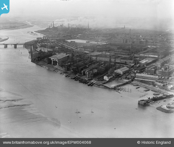
EPW004068 ENGLAND (1920). The Shipbuilding Yard, Barrow-in-Furness, 1920
© Hawlfraint cyfranwyr OpenStreetMap a thrwyddedwyd gan yr OpenStreetMap Foundation. 2026. Trwyddedir y gartograffeg fel CC BY-SA.
Manylion
| Pennawd | [EPW004068] The Shipbuilding Yard, Barrow-in-Furness, 1920 |
| Cyfeirnod | EPW004068 |
| Dyddiad | July-1920 |
| Dolen | |
| Enw lle | BARROW ISLAND |
| Plwyf | |
| Ardal | |
| Gwlad | ENGLAND |
| Dwyreiniad / Gogleddiad | 319277, 468078 |
| Hydred / Lledred | -3.2346516531018, 54.102072326335 |
| Cyfeirnod Grid Cenedlaethol | SD193681 |
Pinnau
Cyfraniadau Grŵp

Robert - Cumbria |
Tuesday 26th of June 2012 08:52:05 PM |


![[EPW004068] The Shipbuilding Yard, Barrow-in-Furness, 1920](http://britainfromabove.org.uk/sites/all/libraries/aerofilms-images/public/100x100/EPW/004/EPW004068.jpg)
![[EPW004064] The Shipbuilding Yard and Naval Construction Works, Barrow-in-Furness, 1920](http://britainfromabove.org.uk/sites/all/libraries/aerofilms-images/public/100x100/EPW/004/EPW004064.jpg)
