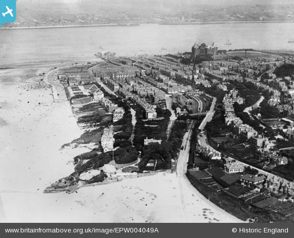
EPW004049A ENGLAND (1920). General view of the town and The Tower, New Brighton, 1920
© Hawlfraint cyfranwyr OpenStreetMap a thrwyddedwyd gan yr OpenStreetMap Foundation. 2026. Trwyddedir y gartograffeg fel CC BY-SA.
Manylion
| Pennawd | [EPW004049A] General view of the town and The Tower, New Brighton, 1920 |
| Cyfeirnod | EPW004049A |
| Dyddiad | August-1920 |
| Dolen | |
| Enw lle | NEW BRIGHTON |
| Plwyf | |
| Ardal | |
| Gwlad | ENGLAND |
| Dwyreiniad / Gogleddiad | 330278, 393988 |
| Hydred / Lledred | -3.0496810034155, 53.437795333851 |
| Cyfeirnod Grid Cenedlaethol | SJ303940 |
Pinnau
Byddwch y cyntaf i ychwanegu sylw at y ddelwedd hon!


![[EPW004049A] General view of the town and The Tower, New Brighton, 1920](http://britainfromabove.org.uk/sites/all/libraries/aerofilms-images/public/100x100/EPW/004/EPW004049A.jpg)
![[EPW045208] King's Parade and the sea front looking across the Mersey towards Liverpool, New Brighton, from the south-west, 1934](http://britainfromabove.org.uk/sites/all/libraries/aerofilms-images/public/100x100/EPW/045/EPW045208.jpg)
![[EPW004046] Wellington Road and environs, New Brighton, 1920](http://britainfromabove.org.uk/sites/all/libraries/aerofilms-images/public/100x100/EPW/004/EPW004046.jpg)

