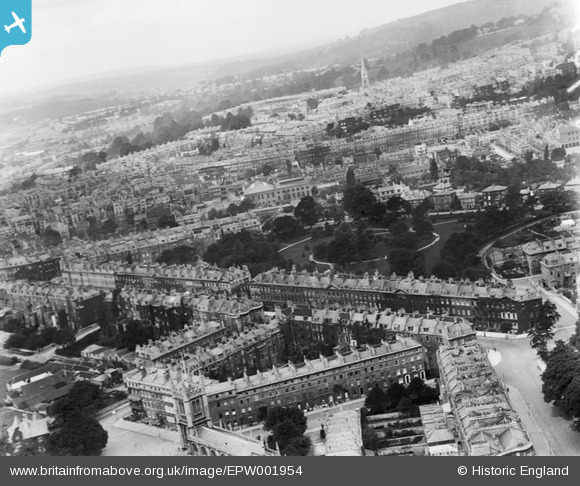
EPW001954 ENGLAND (1920). General view over Henrietta Park and north Bath, Bath, from the south-east, 1920
    © Hawlfraint cyfranwyr OpenStreetMap a thrwyddedwyd gan yr OpenStreetMap Foundation. 2025. Trwyddedir y gartograffeg fel CC BY-SA.
  
Delweddau cyfagos (15)
Manylion
| Pennawd | [EPW001954] General view over Henrietta Park and north Bath, Bath, from the south-east, 1920 | 
| Cyfeirnod | EPW001954 | 
| Dyddiad | July-1920 | 
| Dolen | |
| Enw lle | BATH | 
| Plwyf | |
| Ardal | |
| Gwlad | ENGLAND | 
| Dwyreiniad / Gogleddiad | 375559, 165138 | 
| Hydred / Lledred | -2.3512564855258, 51.384264833156 | 
| Cyfeirnod Grid Cenedlaethol | ST756651 | 
Pinnau
|  Queen's Parade | Class31 | Monday 19th of November 2012 04:51:34 PM | 
|  St. Andrew's Church | Class31 | Monday 19th of November 2012 04:50:40 PM | 
|  Royal Cresent |   Mitch | Saturday 27th of October 2012 09:22:53 PM | 
|  The Circus |   Mitch | Saturday 27th of October 2012 09:21:57 PM | 
|  Daniel Street |   Mitch | Saturday 27th of October 2012 09:19:40 PM | 
|  Sutton Street |   Mitch | Saturday 27th of October 2012 09:19:07 PM | 
|  Henrietta Gardens |   Mitch | Saturday 27th of October 2012 09:18:20 PM | 
|  Henrietta Street(joins Henrietta Road) |   Mitch | Saturday 27th of October 2012 09:14:04 PM | 
|  Pulteney mews |   Mitch | Saturday 27th of October 2012 09:11:54 PM | 
|  Henrietta Road |   Mitch | Saturday 27th of October 2012 08:27:01 PM | 
|  William Street |   Mitch | Saturday 27th of October 2012 08:25:16 PM | 
|  Laura Place | Class31 | Tuesday 10th of July 2012 10:54:50 AM | 
|  The Paragon | Class31 | Tuesday 10th of July 2012 10:53:48 AM | 
|  Great Pulteney Street | Class31 | Tuesday 10th of July 2012 10:52:19 AM | 
|  Sydney Place | Class31 | Tuesday 10th of July 2012 10:51:45 AM | 
|  Darlington Street | Class31 | Tuesday 10th of July 2012 10:51:22 AM | 
|  St. Mary the Virgin | Class31 | Tuesday 10th of July 2012 10:50:56 AM | 
|  Edward Street | Class31 | Tuesday 10th of July 2012 10:50:26 AM | 
Cyfraniadau Grŵp
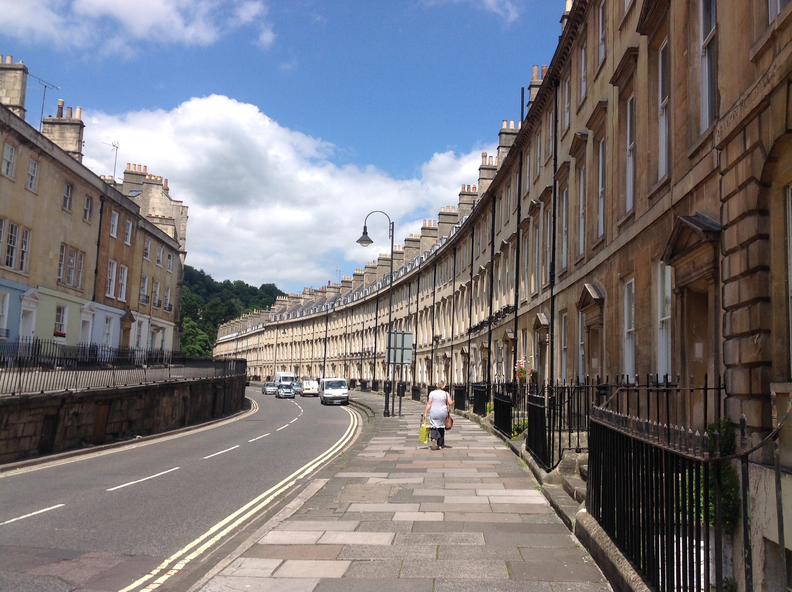
| The Paragon, Bath, 15/07/2014 | Class31 | Wednesday 16th of July 2014 08:36:33 PM | 
 
             
  ![[EPW001954] General view over Henrietta Park and north Bath, Bath, from the south-east, 1920](http://britainfromabove.org.uk/sites/all/libraries/aerofilms-images/public/100x100/EPW/001/EPW001954.jpg) 
  
                                          ![[EAW000751] Great Pulteney Street, Henrietta Park and Sydney Gardens, Bath, 1946](http://britainfromabove.org.uk/sites/all/libraries/aerofilms-images/public/100x100/EAW/000/EAW000751.jpg) 
 ![[EAW026451] Henrietta Park and the city centre, Bath, from the east, 1949](http://britainfromabove.org.uk/sites/all/libraries/aerofilms-images/public/100x100/EAW/026/EAW026451.jpg) 
 ![[EPW001955] The Holburne Museum and environs, Bath, 1920](http://britainfromabove.org.uk/sites/all/libraries/aerofilms-images/public/100x100/EPW/001/EPW001955.jpg) 
 ![[EAW000750] Laura Place, Henrietta Park and Great Pulteney Street, Bath, 1946](http://britainfromabove.org.uk/sites/all/libraries/aerofilms-images/public/100x100/EAW/000/EAW000750.jpg) 
 ![[EAW000753] Laura Place, Henrietta Park and Great Pulteney Street, Bath, 1946](http://britainfromabove.org.uk/sites/all/libraries/aerofilms-images/public/100x100/EAW/000/EAW000753.jpg) 
 ![[EAW023883] The city, Bath, from the east, 1949. This image has been produced from a print.](http://britainfromabove.org.uk/sites/all/libraries/aerofilms-images/public/100x100/EAW/023/EAW023883.jpg) 
 ![[EAW049900] Bath, the second day of the Somerset-Kent county cricket match, 1953](http://britainfromabove.org.uk/sites/all/libraries/aerofilms-images/public/100x100/EAW/049/EAW049900.jpg) 
 ![[EPW048377] The city, Bath, from the north-east, 1935](http://britainfromabove.org.uk/sites/all/libraries/aerofilms-images/public/100x100/EPW/048/EPW048377.jpg) 
 ![[EPW001938] Sydney Gardens and Great Pulteney Street, Bath, 1920](http://britainfromabove.org.uk/sites/all/libraries/aerofilms-images/public/100x100/EPW/001/EPW001938.jpg) 
 ![[EAW000752] Laura Place, Henrietta Park and Great Pulteney Street, Bath, from the south-west, 1946](http://britainfromabove.org.uk/sites/all/libraries/aerofilms-images/public/100x100/EAW/000/EAW000752.jpg) 
 ![[EAW049899] Bath, the second day of the Somerset-Kent county cricket match, 1953](http://britainfromabove.org.uk/sites/all/libraries/aerofilms-images/public/100x100/EAW/049/EAW049899.jpg) 
 ![[EPW001937] Raby Place and environs, Bath, 1920](http://britainfromabove.org.uk/sites/all/libraries/aerofilms-images/public/100x100/EPW/001/EPW001937.jpg) 
 ![[EAW049901] Bath, the second day of the Somerset-Kent county cricket match, 1953](http://britainfromabove.org.uk/sites/all/libraries/aerofilms-images/public/100x100/EAW/049/EAW049901.jpg) 
 ![[EPW048402] Bath and County Recreation Ground, the Cricket Ground and environs, Bath, 1935](http://britainfromabove.org.uk/sites/all/libraries/aerofilms-images/public/100x100/EPW/048/EPW048402.jpg)