
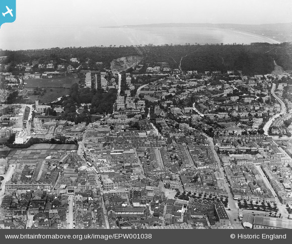
EPW001038 ENGLAND (1920). View over Weston-Super-Mare, Weston-Super-Mare, from the south, 1920
© Hawlfraint cyfranwyr OpenStreetMap a thrwyddedwyd gan yr OpenStreetMap Foundation. 2026. Trwyddedir y gartograffeg fel CC BY-SA.
Delweddau cyfagos (5)
EPW001038

EPW048456

EPW048457

EPW039936

EAW056067

Manylion
| Pennawd | [EPW001038] View over Weston-Super-Mare, Weston-Super-Mare, from the south, 1920 |
| Cyfeirnod | EPW001038 |
| Dyddiad | May-1920 |
| Dolen | |
| Enw lle | WESTON-SUPER-MARE |
| Plwyf | WESTON-SUPER-MARE |
| Ardal | |
| Gwlad | ENGLAND |
| Dwyreiniad / Gogleddiad | 332008, 161439 |
| Hydred / Lledred | -2.9763804029769, 51.347458500411 |
| Cyfeirnod Grid Cenedlaethol | ST320614 |
Pinnau
Byddwch y cyntaf i ychwanegu sylw at y ddelwedd hon!