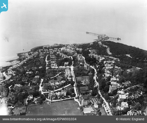
EPW001034 ENGLAND (1920). View over Weston-Super-Mare towards Birnbeck Island, Weston-Super-Mare, from the east, 1920
© Hawlfraint cyfranwyr OpenStreetMap a thrwyddedwyd gan yr OpenStreetMap Foundation. 2026. Trwyddedir y gartograffeg fel CC BY-SA.
Manylion
| Pennawd | [EPW001034] View over Weston-Super-Mare towards Birnbeck Island, Weston-Super-Mare, from the east, 1920 |
| Cyfeirnod | EPW001034 |
| Dyddiad | May-1920 |
| Dolen | |
| Enw lle | WESTON-SUPER-MARE |
| Plwyf | WESTON-SUPER-MARE |
| Ardal | |
| Gwlad | ENGLAND |
| Dwyreiniad / Gogleddiad | 331607, 162276 |
| Hydred / Lledred | -2.9822988731893, 51.354936183599 |
| Cyfeirnod Grid Cenedlaethol | ST316623 |
Pinnau

KevinE |
Sunday 7th of June 2020 09:37:32 PM | |

Gen_Hancock |
Friday 3rd of February 2017 01:38:25 PM | |

Pete L |
Wednesday 24th of June 2015 10:26:53 PM | |

Pete L |
Wednesday 24th of June 2015 10:22:22 PM | |

Pete L |
Wednesday 24th of June 2015 10:08:18 PM | |

Pete L |
Wednesday 24th of June 2015 10:06:30 PM | |

Pete L |
Wednesday 24th of June 2015 10:05:41 PM | |

Pete L |
Wednesday 24th of June 2015 10:01:59 PM |
Cyfraniadau Grŵp
Birnbeck Pier and Birnbeck Island, Weston-super-Mare, 22/09/2016 |

Class31 |
Sunday 19th of February 2017 10:40:30 AM |


![[EPW001034] View over Weston-Super-Mare towards Birnbeck Island, Weston-Super-Mare, from the east, 1920](http://britainfromabove.org.uk/sites/all/libraries/aerofilms-images/public/100x100/EPW/001/EPW001034.jpg)
![[EPW051731] Glentworth Bay and the town, Weston-super-Mare, from the north-west, 1936. This image has been produced from a copy-negative.](http://britainfromabove.org.uk/sites/all/libraries/aerofilms-images/public/100x100/EPW/051/EPW051731.jpg)