
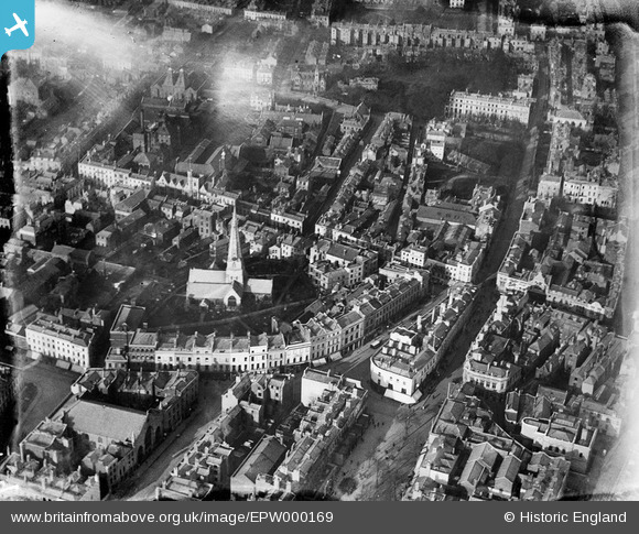
EPW000169 ENGLAND (1920). St Mary's Church, Cheltenham, 1920
© Hawlfraint cyfranwyr OpenStreetMap a thrwyddedwyd gan yr OpenStreetMap Foundation. 2026. Trwyddedir y gartograffeg fel CC BY-SA.
Delweddau cyfagos (8)
EPW000169

EAW006882

EPW000198

EPW000197

EPW000165

EAW038120

EAW038121

EPW000196

Manylion
| Pennawd | [EPW000169] St Mary's Church, Cheltenham, 1920 |
| Cyfeirnod | EPW000169 |
| Dyddiad | February-1920 |
| Dolen | |
| Enw lle | CHELTENHAM |
| Plwyf | |
| Ardal | |
| Gwlad | ENGLAND |
| Dwyreiniad / Gogleddiad | 394875, 222546 |
| Hydred / Lledred | -2.0744963998799, 51.900996927123 |
| Cyfeirnod Grid Cenedlaethol | SO949225 |
Pinnau

Class31 |
Tuesday 16th of October 2012 04:31:42 PM | |
|
Class31 |
Tuesday 16th of October 2012 04:30:58 PM | |
|
Class31 |
Tuesday 16th of October 2012 04:30:37 PM | |
|
Class31 |
Tuesday 16th of October 2012 04:29:03 PM | |
|
Class31 |
Tuesday 16th of October 2012 04:28:46 PM | |
|
Class31 |
Tuesday 16th of October 2012 04:28:27 PM | |
|
Class31 |
Tuesday 16th of October 2012 04:28:02 PM | |

Toby Clempson |
Wednesday 27th of June 2012 07:37:07 AM | |
|
Toby Clempson |
Wednesday 27th of June 2012 07:34:24 AM |
Cyfraniadau Grŵp

St. Mary's Church 27/09/2013 |
Class31 |
Monday 30th of September 2013 08:51:59 AM |