
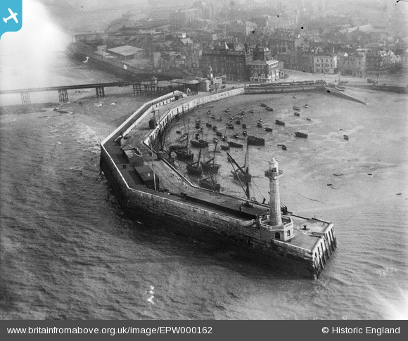
EPW000162 ENGLAND (1920). The Harbour Pier, Margate, 1920
© Hawlfraint cyfranwyr OpenStreetMap a thrwyddedwyd gan yr OpenStreetMap Foundation. 2026. Trwyddedir y gartograffeg fel CC BY-SA.
Delweddau cyfagos (13)
EPW000162

EAW015841

EPW018607

EPW048847

EPW000625

EPW018599

EPW000631

EPW048845

EPW000627

EAW015840

EPW048846

EPW009241

EPW052890

Manylion
| Pennawd | [EPW000162] The Harbour Pier, Margate, 1920 |
| Cyfeirnod | EPW000162 |
| Dyddiad | February-1920 |
| Dolen | |
| Enw lle | MARGATE |
| Plwyf | |
| Ardal | |
| Gwlad | ENGLAND |
| Dwyreiniad / Gogleddiad | 635160, 171186 |
| Hydred / Lledred | 1.3805081213804, 51.390404873301 |
| Cyfeirnod Grid Cenedlaethol | TR352712 |
Pinnau

MB |
Friday 21st of September 2012 06:43:21 PM |