
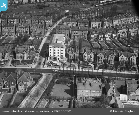
EPR000501 ENGLAND (1935). Hillcrest Court off Shoot Up Hill and adjacent properties, West Hampstead, 1935
© Hawlfraint cyfranwyr OpenStreetMap a thrwyddedwyd gan yr OpenStreetMap Foundation. 2026. Trwyddedir y gartograffeg fel CC BY-SA.
Delweddau cyfagos (2)
EPR000501

EPW021372

Manylion
| Pennawd | [EPR000501] Hillcrest Court off Shoot Up Hill and adjacent properties, West Hampstead, 1935 |
| Cyfeirnod | EPR000501 |
| Dyddiad | 1935 |
| Dolen | |
| Enw lle | WEST HAMPSTEAD |
| Plwyf | |
| Ardal | |
| Gwlad | ENGLAND |
| Dwyreiniad / Gogleddiad | 524436, 184988 |
| Hydred / Lledred | -0.20511722177229, 51.549565145923 |
| Cyfeirnod Grid Cenedlaethol | TQ244850 |
Pinnau

Captaintee |
Sunday 2nd of December 2018 07:31:47 PM | |
|
Captaintee |
Sunday 2nd of December 2018 07:30:15 PM |