
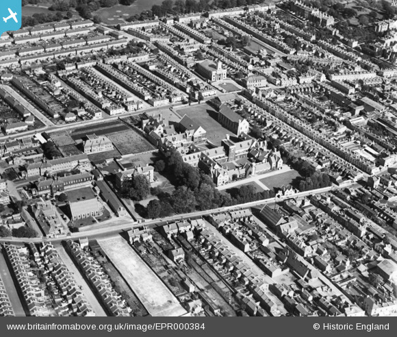
EPR000384 ENGLAND (1934). St Paul's Training College and environs, Cheltenham, 1934
© Hawlfraint cyfranwyr OpenStreetMap a thrwyddedwyd gan yr OpenStreetMap Foundation. 2026. Trwyddedir y gartograffeg fel CC BY-SA.
Delweddau cyfagos (2)
EPR000384

EPW001315

Manylion
| Pennawd | [EPR000384] St Paul's Training College and environs, Cheltenham, 1934 |
| Cyfeirnod | EPR000384 |
| Dyddiad | 28-September-1934 |
| Dolen | |
| Enw lle | CHELTENHAM |
| Plwyf | |
| Ardal | |
| Gwlad | ENGLAND |
| Dwyreiniad / Gogleddiad | 394594, 223058 |
| Hydred / Lledred | -2.0785890125089, 51.905598113484 |
| Cyfeirnod Grid Cenedlaethol | SO946231 |
Pinnau

Tess |
Wednesday 27th of September 2017 10:19:17 AM | |
|
Tess |
Wednesday 27th of September 2017 10:18:46 AM | |
|
Tess |
Wednesday 27th of September 2017 10:18:09 AM | |
|
Tess |
Wednesday 27th of September 2017 10:15:51 AM | |
|
Tess |
Wednesday 27th of September 2017 10:07:50 AM | |
 |
Tess |
Wednesday 27th of September 2017 10:05:46 AM |
|
Tess |
Wednesday 27th of September 2017 10:03:41 AM | |
|
stephanie1971 |
Saturday 15th of August 2015 11:54:27 PM |