
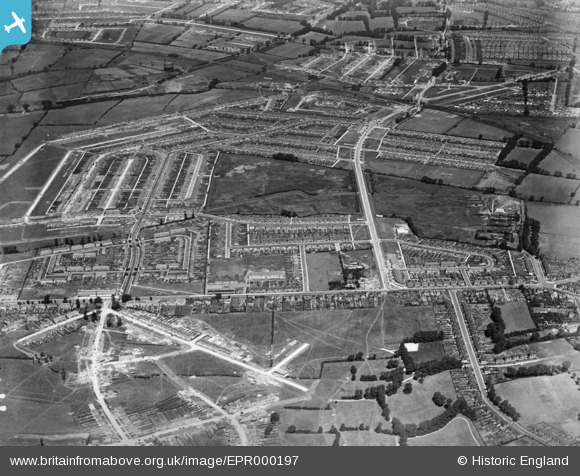
EPR000197 ENGLAND (1934). The Tithe Farm Housing Estate under construction, South Harrow, 1934
© Hawlfraint cyfranwyr OpenStreetMap a thrwyddedwyd gan yr OpenStreetMap Foundation. 2026. Trwyddedir y gartograffeg fel CC BY-SA.
Delweddau cyfagos (3)
EPR000197

EPR000198

EPR000200A

Manylion
| Pennawd | [EPR000197] The Tithe Farm Housing Estate under construction, South Harrow, 1934 |
| Cyfeirnod | EPR000197 |
| Dyddiad | 17-July-1934 |
| Dolen | |
| Enw lle | SOUTH HARROW |
| Plwyf | |
| Ardal | |
| Gwlad | ENGLAND |
| Dwyreiniad / Gogleddiad | 513051, 186516 |
| Hydred / Lledred | -0.3687694970874, 51.565696516278 |
| Cyfeirnod Grid Cenedlaethol | TQ131865 |
Pinnau

Roy Cousins |
Thursday 2nd of April 2015 03:39:24 PM | |
|
Roy Cousins |
Thursday 2nd of April 2015 03:37:42 PM | |
|
Roy Cousins |
Thursday 2nd of April 2015 03:36:17 PM | |
|
Roy Cousins |
Thursday 2nd of April 2015 03:34:47 PM | |
|
Roy Cousins |
Thursday 2nd of April 2015 03:33:13 PM | |
|
Roy Cousins |
Thursday 2nd of April 2015 03:31:42 PM |