
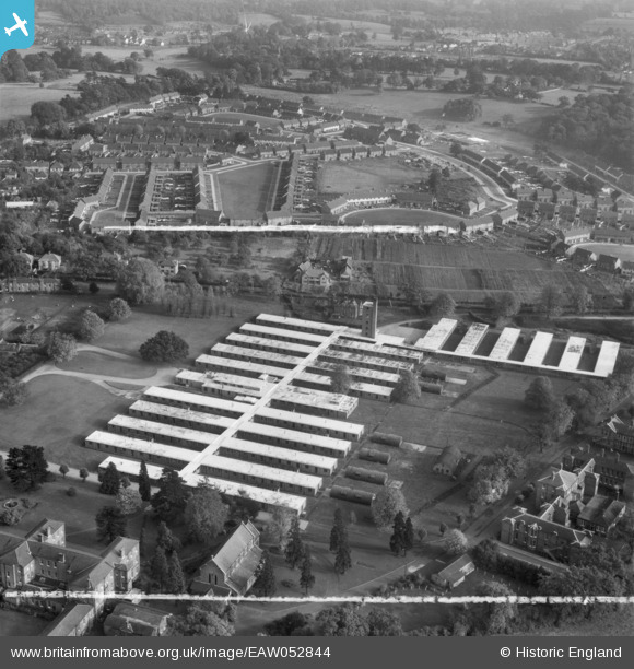
EAW052844 ENGLAND (1953). Abbots Langley Hospital alongside the residential area at Woodside, Abbots Langley, 1953. This image was marked by Aerofilms Ltd for photo editing.
© Hawlfraint cyfranwyr OpenStreetMap a thrwyddedwyd gan yr OpenStreetMap Foundation. 2026. Trwyddedir y gartograffeg fel CC BY-SA.
Delweddau cyfagos (9)
EAW052844

EAW052847

EAW052848

EAW052843

EAW052845

EAW052849

EAW052846

EAW052842

EPW047067

Manylion
| Pennawd | [EAW052844] Abbots Langley Hospital alongside the residential area at Woodside, Abbots Langley, 1953. This image was marked by Aerofilms Ltd for photo editing. |
| Cyfeirnod | EAW052844 |
| Dyddiad | 16-October-1953 |
| Dolen | |
| Enw lle | ABBOTS LANGLEY |
| Plwyf | ABBOTS LANGLEY |
| Ardal | |
| Gwlad | ENGLAND |
| Dwyreiniad / Gogleddiad | 510344, 201224 |
| Hydred / Lledred | -0.40317613302739, 51.698440364319 |
| Cyfeirnod Grid Cenedlaethol | TL103012 |
Pinnau

Howard |
Friday 7th of October 2022 10:04:20 PM | |

Matt Aldred edob.mattaldred.com |
Tuesday 27th of April 2021 01:38:15 PM |