
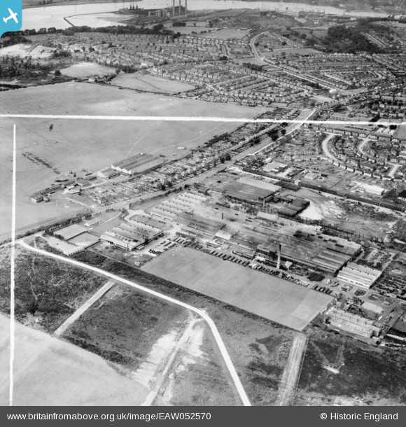
EAW052570 ENGLAND (1953). The Crane Ltd Nacton Works and environs, Priory Heath, 1953. This image was marked by Aerofilms Ltd for photo editing.
© Hawlfraint cyfranwyr OpenStreetMap a thrwyddedwyd gan yr OpenStreetMap Foundation. 2025. Trwyddedir y gartograffeg fel CC BY-SA.
Delweddau cyfagos (21)
EAW052570

EPW046601

EPW046597

EPW046598

EPW046596

EPW046595

EPW046600

EPW046604

EPW046605

EPW032870

EAW052568

EPW046599

EPW046602

EPW032869

EAW052569

EAW052567

EAW052571

EAW052573

EAW052572

EPW046603

EAW052574

Manylion
| Pennawd | [EAW052570] The Crane Ltd Nacton Works and environs, Priory Heath, 1953. This image was marked by Aerofilms Ltd for photo editing. |
| Cyfeirnod | EAW052570 |
| Dyddiad | 5-October-1953 |
| Dolen | |
| Enw lle | PRIORY HEATH |
| Plwyf | |
| Ardal | |
| Gwlad | ENGLAND |
| Dwyreiniad / Gogleddiad | 619557, 242006 |
| Hydred / Lledred | 1.2012128547002, 52.032501765858 |
| Cyfeirnod Grid Cenedlaethol | TM196420 |
Pinnau

Matt Aldred edob.mattaldred.com |
Sunday 16th of May 2021 08:57:32 PM | |
|
Matt Aldred edob.mattaldred.com |
Sunday 7th of March 2021 11:32:41 AM | |

Where's Canning Town? |
Saturday 31st of October 2015 08:10:52 PM | |
|
Where's Canning Town? |
Tuesday 28th of October 2014 10:25:06 PM |