
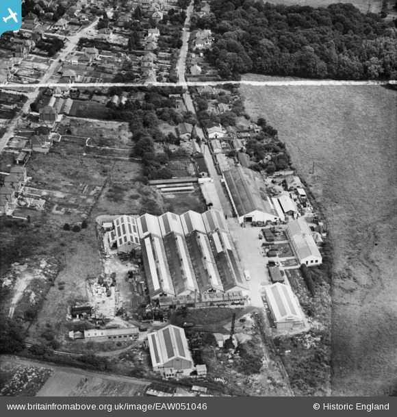
EAW051046 ENGLAND (1953). The Martin-Baker Aircraft Co Ltd Works, Higher Denham, 1953. This image was marked by Aerofilms Ltd for photo editing.
© Hawlfraint cyfranwyr OpenStreetMap a thrwyddedwyd gan yr OpenStreetMap Foundation. 2026. Trwyddedir y gartograffeg fel CC BY-SA.
Delweddau cyfagos (9)
EAW051046

EAW051045

EAW051040

EAW051042

EAW051043

EAW051039

EAW051041

EAW051044

EPW043074

Manylion
| Pennawd | [EAW051046] The Martin-Baker Aircraft Co Ltd Works, Higher Denham, 1953. This image was marked by Aerofilms Ltd for photo editing. |
| Cyfeirnod | EAW051046 |
| Dyddiad | 3-August-1953 |
| Dolen | |
| Enw lle | HIGHER DENHAM |
| Plwyf | DENHAM |
| Ardal | |
| Gwlad | ENGLAND |
| Dwyreiniad / Gogleddiad | 502290, 187714 |
| Hydred / Lledred | -0.52363436157074, 51.578520983569 |
| Cyfeirnod Grid Cenedlaethol | TQ023877 |
Pinnau

clippedwings |
Wednesday 29th of April 2015 08:55:33 PM | |

The Laird |
Wednesday 29th of April 2015 06:38:09 PM | |
|
moses72 |
Tuesday 23rd of September 2014 11:26:20 AM |