
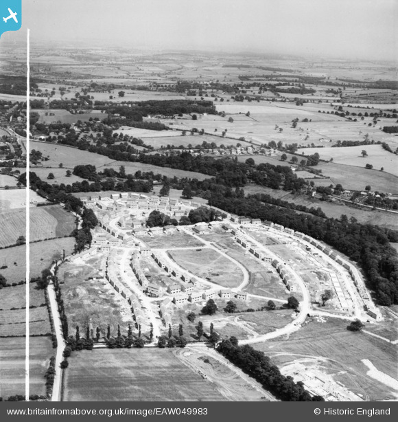
EAW049983 ENGLAND (1953). The residential area at Kettlethorpe under construction, Wakefield, from the west, 1953. This image was marked by Aerofilms Ltd for photo editing.
© Hawlfraint cyfranwyr OpenStreetMap a thrwyddedwyd gan yr OpenStreetMap Foundation. 2026. Trwyddedir y gartograffeg fel CC BY-SA.
Delweddau cyfagos (8)
EAW049983

EAW049982

EAW050036

EAW049985

EAW049981

EAW049986

EAW049988

EAW049987

Manylion
| Pennawd | [EAW049983] The residential area at Kettlethorpe under construction, Wakefield, from the west, 1953. This image was marked by Aerofilms Ltd for photo editing. |
| Cyfeirnod | EAW049983 |
| Dyddiad | 18-June-1953 |
| Dolen | |
| Enw lle | WAKEFIELD |
| Plwyf | |
| Ardal | |
| Gwlad | ENGLAND |
| Dwyreiniad / Gogleddiad | 432805, 416473 |
| Hydred / Lledred | -1.5037192019113, 53.643505077845 |
| Cyfeirnod Grid Cenedlaethol | SE328165 |
Pinnau
Byddwch y cyntaf i ychwanegu sylw at y ddelwedd hon!