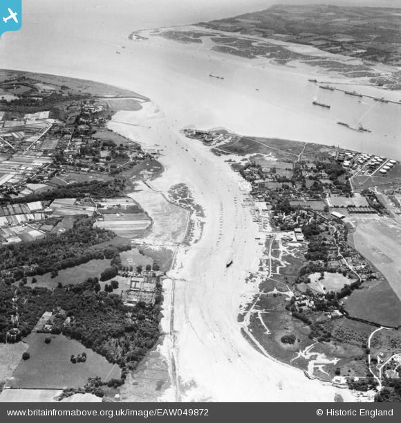
EAW049872 ENGLAND (1953). The River Hamble, Warsash, 1953
    © Hawlfraint cyfranwyr OpenStreetMap a thrwyddedwyd gan yr OpenStreetMap Foundation. 2025. Trwyddedir y gartograffeg fel CC BY-SA.
  
Delweddau cyfagos (8)
Manylion
| Pennawd | [EAW049872] The River Hamble, Warsash, 1953 | 
| Cyfeirnod | EAW049872 | 
| Dyddiad | 9-June-1953 | 
| Dolen | |
| Enw lle | WARSASH | 
| Plwyf | |
| Ardal | |
| Gwlad | ENGLAND | 
| Dwyreiniad / Gogleddiad | 448698, 106935 | 
| Hydred / Lledred | -1.3080163281973, 50.859315294858 | 
| Cyfeirnod Grid Cenedlaethol | SU487069 | 
Pinnau
|  ? 2ndWW pillbox. |   redmist | Wednesday 26th of July 2023 09:13:44 PM | 
|  ? 2ndWW pillbox. |   redmist | Wednesday 26th of July 2023 09:13:08 PM | 
|  Location of a 2ndWW LAA Bofors tower. e27098. |   redmist | Wednesday 26th of July 2023 07:48:42 PM | 
|  2ndWW pillbox, type 22. |   redmist | Wednesday 26th of July 2023 07:39:59 PM | 
|  2ndWW fuel storage site, e43519. |   redmist | Tuesday 25th of July 2023 10:04:43 AM | 
|  2ndWW pillbox, type FW3/26, S0012713. |   redmist | Tuesday 25th of July 2023 10:02:30 AM | 
|  2ndWW LAA gun position. |   redmist | Tuesday 25th of July 2023 09:55:31 AM | 
|  Training ship "Mercury". AKA HMS Gannet, anchored here from 1914 to 1968 now restored and preserved at Chatham historic dock yard. |   rog8811 | Sunday 6th of December 2015 02:31:08 PM | 
| Class31 | Saturday 21st of March 2015 05:21:50 PM | 
 
             
  ![[EAW049872] The River Hamble, Warsash, 1953](http://britainfromabove.org.uk/sites/all/libraries/aerofilms-images/public/100x100/EAW/049/EAW049872.jpg) 
  
                                          ![[EAW049860] The River Hamble looking across the village and Hamble airfield to Southampton Water, Warsash, from the east, 1953. This image was marked by Aerofilms Ltd for photo editing.](http://britainfromabove.org.uk/sites/all/libraries/aerofilms-images/public/100x100/EAW/049/EAW049860.jpg) 
 ![[EAW049866] The waterfront and Hamble Airfield, Hamble-le-Rice, from the south-east, 1953. This image was marked by Aerofilms Ltd for photo editing.](http://britainfromabove.org.uk/sites/all/libraries/aerofilms-images/public/100x100/EAW/049/EAW049866.jpg) 
 ![[EAW049868] The River Hamble and Southampton Water, Hamble-le-Rice, 1953](http://britainfromabove.org.uk/sites/all/libraries/aerofilms-images/public/100x100/EAW/049/EAW049868.jpg) 
 ![[EAW049867] The waterfront and village, Hamble-le-Rice, from the east, 1953](http://britainfromabove.org.uk/sites/all/libraries/aerofilms-images/public/100x100/EAW/049/EAW049867.jpg) 
 ![[EAW049858] The waterfront and Hamble Airfield, Hamble-le-Rice, from the south-east, 1953. This image was marked by Aerofilms Ltd for photo editing.](http://britainfromabove.org.uk/sites/all/libraries/aerofilms-images/public/100x100/EAW/049/EAW049858.jpg) 
 ![[EAW049859] The waterfront, Hamble-le-Rice, from the south-east, 1953. This image was marked by Aerofilms Ltd for photo editing.](http://britainfromabove.org.uk/sites/all/libraries/aerofilms-images/public/100x100/EAW/049/EAW049859.jpg) 
 ![[EAW049862] The River Hamble, waterfront and village, Hamble-le-Rice, 1953](http://britainfromabove.org.uk/sites/all/libraries/aerofilms-images/public/100x100/EAW/049/EAW049862.jpg)