
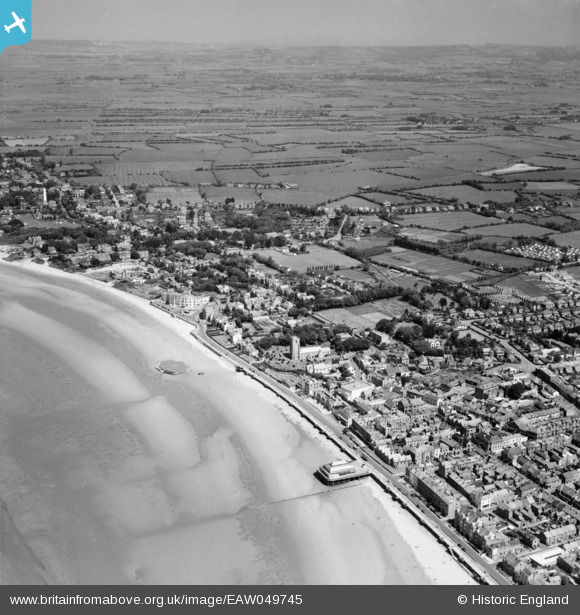
EAW049745 ENGLAND (1953). The town, Burnham-on-Sea, from the south-west, 1953
© Hawlfraint cyfranwyr OpenStreetMap a thrwyddedwyd gan yr OpenStreetMap Foundation. 2026. Trwyddedir y gartograffeg fel CC BY-SA.
Delweddau cyfagos (5)
EAW049745

EPW027964

EPW039925

EAW049744

EPW039928

Manylion
| Pennawd | [EAW049745] The town, Burnham-on-Sea, from the south-west, 1953 |
| Cyfeirnod | EAW049745 |
| Dyddiad | 28-May-1953 |
| Dolen | |
| Enw lle | BURNHAM-ON-SEA |
| Plwyf | BURNHAM-ON-SEA AND HIGHBRIDGE |
| Ardal | |
| Gwlad | ENGLAND |
| Dwyreiniad / Gogleddiad | 330323, 149302 |
| Hydred / Lledred | -2.9982041097429, 51.238125049501 |
| Cyfeirnod Grid Cenedlaethol | ST303493 |
Pinnau

Cider son |
Thursday 27th of October 2016 02:47:22 PM | |
|
Cider son |
Thursday 27th of October 2016 02:46:15 PM | |
|
Cider son |
Thursday 27th of October 2016 02:45:31 PM | |
|
Cider son |
Thursday 27th of October 2016 02:44:58 PM | |
|
Cider son |
Thursday 27th of October 2016 02:43:36 PM | |
|
Cider son |
Thursday 27th of October 2016 02:40:37 PM | |
|
Cider son |
Thursday 27th of October 2016 02:38:55 PM | |
|
Cider son |
Thursday 27th of October 2016 02:38:07 PM | |
|
Cider son |
Thursday 27th of October 2016 02:37:11 PM | |
|
Cider son |
Thursday 27th of October 2016 02:34:44 PM | |
|
Cider son |
Thursday 27th of October 2016 02:33:47 PM | |
|
Cider son |
Thursday 4th of December 2014 04:46:40 PM | |
|
hilary |
Thursday 24th of July 2014 04:07:42 PM |