
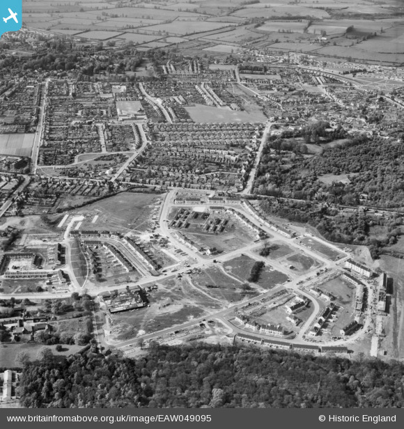
EAW049095 ENGLAND (1953). Wood Farm estate under construction and environs, New Headington, 1953
© Hawlfraint cyfranwyr OpenStreetMap a thrwyddedwyd gan yr OpenStreetMap Foundation. 2026. Trwyddedir y gartograffeg fel CC BY-SA.
Delweddau cyfagos (2)
EAW049095

EAW003903

Manylion
| Pennawd | [EAW049095] Wood Farm estate under construction and environs, New Headington, 1953 |
| Cyfeirnod | EAW049095 |
| Dyddiad | 5-May-1953 |
| Dolen | |
| Enw lle | NEW HEADINGTON |
| Plwyf | |
| Ardal | |
| Gwlad | ENGLAND |
| Dwyreiniad / Gogleddiad | 455268, 206319 |
| Hydred / Lledred | -1.1992642999812, 51.752379889373 |
| Cyfeirnod Grid Cenedlaethol | SP553063 |
Pinnau

Stephanie (Oxford) |
Thursday 14th of October 2021 02:38:38 PM | |
|
Stephanie (Oxford) |
Thursday 14th of October 2021 02:36:45 PM | |
|
Stephanie (Oxford) |
Thursday 14th of October 2021 02:34:59 PM | |
|
Stephanie (Oxford) |
Thursday 14th of October 2021 02:33:16 PM |