
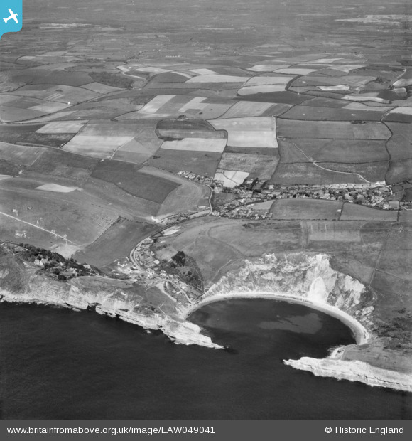
EAW049041 ENGLAND (1953). Lulworth Cove, the village and the surrounding countryside, West Lulworth, from the south, 1953
© Hawlfraint cyfranwyr OpenStreetMap a thrwyddedwyd gan yr OpenStreetMap Foundation. 2026. Trwyddedir y gartograffeg fel CC BY-SA.
Delweddau cyfagos (9)
EAW049041

EPW013653

EAW049040

EAW002989

EPW013650

EAW049039

EAW035600

EAW035599

EPW013652

Manylion
| Pennawd | [EAW049041] Lulworth Cove, the village and the surrounding countryside, West Lulworth, from the south, 1953 |
| Cyfeirnod | EAW049041 |
| Dyddiad | 4-May-1953 |
| Dolen | |
| Enw lle | WEST LULWORTH |
| Plwyf | WEST LULWORTH |
| Ardal | |
| Gwlad | ENGLAND |
| Dwyreiniad / Gogleddiad | 382469, 79913 |
| Hydred / Lledred | -2.2478325720339, 50.61807584121 |
| Cyfeirnod Grid Cenedlaethol | SY825799 |
Pinnau
Byddwch y cyntaf i ychwanegu sylw at y ddelwedd hon!