
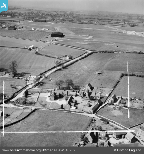
EAW048969 ENGLAND (1953). The Manor House, St John's Church and environs, Barford St John, from the south, 1953. This image was marked by Aerofilms Ltd for photo editing.
© Hawlfraint cyfranwyr OpenStreetMap a thrwyddedwyd gan yr OpenStreetMap Foundation. 2026. Trwyddedir y gartograffeg fel CC BY-SA.
Delweddau cyfagos (6)
EAW048969

EAW048971

EAW048974

EAW048972

EAW048970

EAW048973

Manylion
| Pennawd | [EAW048969] The Manor House, St John's Church and environs, Barford St John, from the south, 1953. This image was marked by Aerofilms Ltd for photo editing. |
| Cyfeirnod | EAW048969 |
| Dyddiad | 5-May-1953 |
| Dolen | |
| Enw lle | BARFORD ST JOHN |
| Plwyf | BARFORD ST. JOHN AND ST. MICHAEL |
| Ardal | |
| Gwlad | ENGLAND |
| Dwyreiniad / Gogleddiad | 443867, 233172 |
| Hydred / Lledred | -1.3610191166683, 51.994834457484 |
| Cyfeirnod Grid Cenedlaethol | SP439332 |
Pinnau

Matt Aldred edob.mattaldred.com |
Wednesday 6th of December 2023 03:02:33 PM | |

John W |
Tuesday 20th of December 2016 05:50:50 PM |