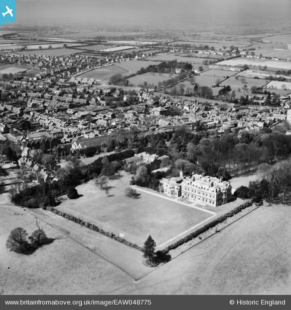
EAW048775 ENGLAND (1953). The Mansion and the town, Tring, from the east, 1953
© Hawlfraint cyfranwyr OpenStreetMap a thrwyddedwyd gan yr OpenStreetMap Foundation. 2026. Trwyddedir y gartograffeg fel CC BY-SA.
Delweddau cyfagos (5)
Manylion
| Pennawd | [EAW048775] The Mansion and the town, Tring, from the east, 1953 |
| Cyfeirnod | EAW048775 |
| Dyddiad | 22-April-1953 |
| Dolen | |
| Enw lle | TRING |
| Plwyf | TRING |
| Ardal | |
| Gwlad | ENGLAND |
| Dwyreiniad / Gogleddiad | 492690, 211129 |
| Hydred / Lledred | -0.65592989426085, 51.790676998806 |
| Cyfeirnod Grid Cenedlaethol | SP927111 |
Pinnau

Mark |
Wednesday 23rd of August 2023 01:09:38 AM |


![[EAW048775] The Mansion and the town, Tring, from the east, 1953](http://britainfromabove.org.uk/sites/all/libraries/aerofilms-images/public/100x100/EAW/048/EAW048775.jpg)
![[EAW048774] The Mansion and the town, Tring, from the east, 1953](http://britainfromabove.org.uk/sites/all/libraries/aerofilms-images/public/100x100/EAW/048/EAW048774.jpg)
![[EPW056442] Tring Park and the town centre, Tring, from the south, 1938](http://britainfromabove.org.uk/sites/all/libraries/aerofilms-images/public/100x100/EPW/056/EPW056442.jpg)
![[EAW048773] The Mansion and the surrounding area, Tring, from the south, 1953](http://britainfromabove.org.uk/sites/all/libraries/aerofilms-images/public/100x100/EAW/048/EAW048773.jpg)
![[EPW001240] View of Tring, Tring, 1920](http://britainfromabove.org.uk/sites/all/libraries/aerofilms-images/public/100x100/EPW/001/EPW001240.jpg)