
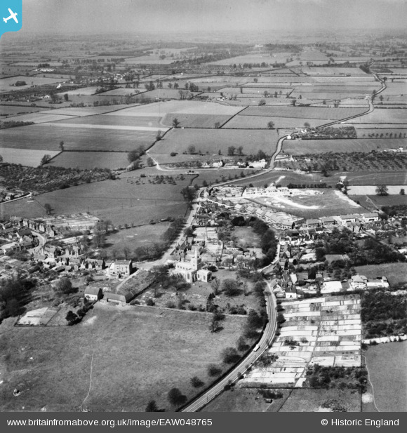
EAW048765 ENGLAND (1953). St Mary's Church, the village and the surrounding countryside, Ivinghoe, from the south-east, 1953
© Hawlfraint cyfranwyr OpenStreetMap a thrwyddedwyd gan yr OpenStreetMap Foundation. 2026. Trwyddedir y gartograffeg fel CC BY-SA.
Delweddau cyfagos (3)
EAW048765

EAW048768

EAW048766

Manylion
| Pennawd | [EAW048765] St Mary's Church, the village and the surrounding countryside, Ivinghoe, from the south-east, 1953 |
| Cyfeirnod | EAW048765 |
| Dyddiad | 22-April-1953 |
| Dolen | |
| Enw lle | IVINGHOE |
| Plwyf | IVINGHOE |
| Ardal | |
| Gwlad | ENGLAND |
| Dwyreiniad / Gogleddiad | 494578, 216166 |
| Hydred / Lledred | -0.62718558200086, 51.83564075084 |
| Cyfeirnod Grid Cenedlaethol | SP946162 |
Pinnau

Dylan Moore |
Monday 20th of May 2019 05:41:52 PM | |
|
Dylan Moore |
Monday 20th of May 2019 05:39:55 PM | |
|
Dylan Moore |
Monday 20th of May 2019 05:38:14 PM | |
|
Dylan Moore |
Monday 20th of May 2019 05:35:39 PM | |
|
Dylan Moore |
Monday 20th of May 2019 05:34:52 PM | |
|
Dylan Moore |
Monday 20th of May 2019 05:33:31 PM |