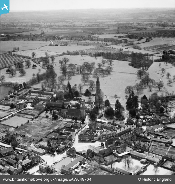
EAW048704 ENGLAND (1953). The village, Hadlow, from the north, 1953
© Hawlfraint cyfranwyr OpenStreetMap a thrwyddedwyd gan yr OpenStreetMap Foundation. 2026. Trwyddedir y gartograffeg fel CC BY-SA.
Manylion
| Pennawd | [EAW048704] The village, Hadlow, from the north, 1953 |
| Cyfeirnod | EAW048704 |
| Dyddiad | 8-April-1953 |
| Dolen | |
| Enw lle | HADLOW |
| Plwyf | HADLOW |
| Ardal | |
| Gwlad | ENGLAND |
| Dwyreiniad / Gogleddiad | 563425, 149756 |
| Hydred / Lledred | 0.3406030953825, 51.223055909449 |
| Cyfeirnod Grid Cenedlaethol | TQ634498 |


![[EAW048704] The village, Hadlow, from the north, 1953](http://britainfromabove.org.uk/sites/all/libraries/aerofilms-images/public/100x100/EAW/048/EAW048704.jpg)
![[EAW048702] Hadlow Tower at Hadlow Castle and the village, Hadlow, 1953](http://britainfromabove.org.uk/sites/all/libraries/aerofilms-images/public/100x100/EAW/048/EAW048702.jpg)
![[EPW060394] Hadlow Castle and St Mary's Church, Hadlow, 1939](http://britainfromabove.org.uk/sites/all/libraries/aerofilms-images/public/100x100/EPW/060/EPW060394.jpg)
![[EAW048703] Hadlow Tower at Hadlow Castle, Hadlow, 1953](http://britainfromabove.org.uk/sites/all/libraries/aerofilms-images/public/100x100/EAW/048/EAW048703.jpg)
