
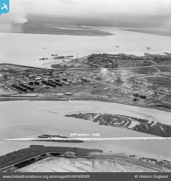
EAW048589 ENGLAND (1953). Upper Horse and the Coryton Oil Refinery under construction, Canvey Island, from the north-east, 1953. This image was marked by Aerofilms Ltd for photo editing.
© Hawlfraint cyfranwyr OpenStreetMap a thrwyddedwyd gan yr OpenStreetMap Foundation. 2026. Trwyddedir y gartograffeg fel CC BY-SA.
Delweddau cyfagos (4)
EAW048589

EAW041997

EAW051377

EAW034443

Manylion
| Pennawd | [EAW048589] Upper Horse and the Coryton Oil Refinery under construction, Canvey Island, from the north-east, 1953. This image was marked by Aerofilms Ltd for photo editing. |
| Cyfeirnod | EAW048589 |
| Dyddiad | 3-April-1953 |
| Dolen | |
| Enw lle | CANVEY ISLAND |
| Plwyf | CANVEY ISLAND |
| Ardal | |
| Gwlad | ENGLAND |
| Dwyreiniad / Gogleddiad | 575257, 182850 |
| Hydred / Lledred | 0.52621221460728, 51.516862892982 |
| Cyfeirnod Grid Cenedlaethol | TQ753829 |
Pinnau
Byddwch y cyntaf i ychwanegu sylw at y ddelwedd hon!