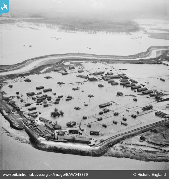
EAW048379 ENGLAND (1953). Flooding at the Thames Ammunition Works, Crayford Ness, 1953
© Hawlfraint cyfranwyr OpenStreetMap a thrwyddedwyd gan yr OpenStreetMap Foundation. 2026. Trwyddedir y gartograffeg fel CC BY-SA.
Manylion
| Pennawd | [EAW048379] Flooding at the Thames Ammunition Works, Crayford Ness, 1953 |
| Cyfeirnod | EAW048379 |
| Dyddiad | 2-February-1953 |
| Dolen | |
| Enw lle | CRAYFORD NESS |
| Plwyf | |
| Ardal | |
| Gwlad | ENGLAND |
| Dwyreiniad / Gogleddiad | 553740, 177922 |
| Hydred / Lledred | 0.21417819684036, 51.478848006454 |
| Cyfeirnod Grid Cenedlaethol | TQ537779 |
Pinnau

Peter Kirk |
Monday 19th of February 2018 06:00:39 PM | |

Kentishman |
Thursday 21st of January 2016 07:39:08 PM | |

Kentishman |
Thursday 21st of January 2016 07:32:45 PM | |

Kentishman |
Thursday 21st of January 2016 07:31:25 PM | |

Kentishman |
Thursday 21st of January 2016 07:29:55 PM | |

Kentishman |
Thursday 21st of January 2016 07:29:11 PM | |

Kentishman |
Thursday 21st of January 2016 07:28:22 PM |


![[EAW048379] Flooding at the Thames Ammunition Works, Crayford Ness, 1953](http://britainfromabove.org.uk/sites/all/libraries/aerofilms-images/public/100x100/EAW/048/EAW048379.jpg)
![[EAW048380] Flooding at the Thames Ammunition Works, Crayford Ness, 1953](http://britainfromabove.org.uk/sites/all/libraries/aerofilms-images/public/100x100/EAW/048/EAW048380.jpg)
![[EAW048378] Flooding at the Thames Ammunition Works, Crayford Ness, 1953](http://britainfromabove.org.uk/sites/all/libraries/aerofilms-images/public/100x100/EAW/048/EAW048378.jpg)