
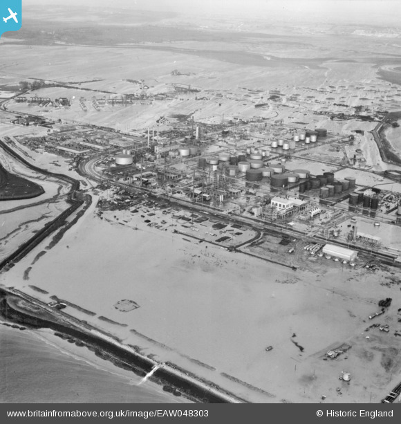
EAW048303 ENGLAND (1953). Flooding at the Coryton Oil Refinery, Coryton, from the south-east, 1953
© Hawlfraint cyfranwyr OpenStreetMap a thrwyddedwyd gan yr OpenStreetMap Foundation. 2026. Trwyddedir y gartograffeg fel CC BY-SA.
Delweddau cyfagos (13)
EAW048303

EAW034434

EAW048090

EAW034431

EAW039890

EAW043888

EAW048586

EAW035773

EAW048585

EPW032110

EAW042282

EAW047435

EAW039891

Manylion
| Pennawd | [EAW048303] Flooding at the Coryton Oil Refinery, Coryton, from the south-east, 1953 |
| Cyfeirnod | EAW048303 |
| Dyddiad | 2-February-1953 |
| Dolen | |
| Enw lle | CORYTON |
| Plwyf | |
| Ardal | |
| Gwlad | ENGLAND |
| Dwyreiniad / Gogleddiad | 575331, 181952 |
| Hydred / Lledred | 0.52683110245795, 51.508772535858 |
| Cyfeirnod Grid Cenedlaethol | TQ753820 |
Pinnau

Tokyo |
Sunday 31st of January 2016 08:37:00 PM |