
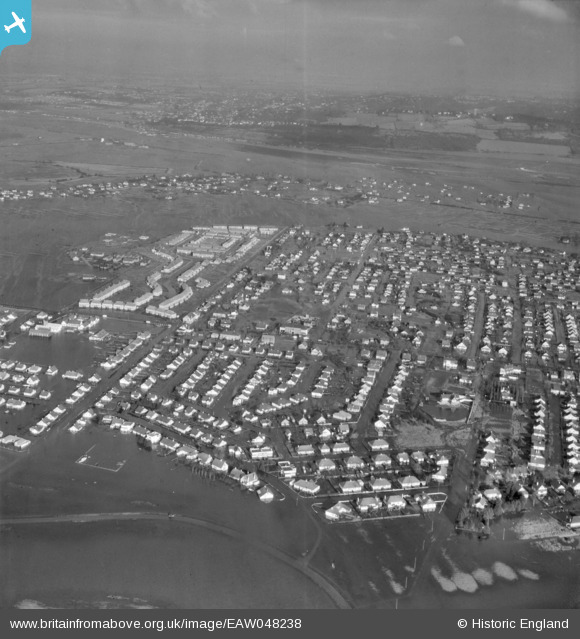
EAW048238 ENGLAND (1953). Flooding around Long Road, Canvey Island, from the south-east, 1953
© Hawlfraint cyfranwyr OpenStreetMap a thrwyddedwyd gan yr OpenStreetMap Foundation. 2026. Trwyddedir y gartograffeg fel CC BY-SA.
Delweddau cyfagos (8)
EAW048238

EAW045308

EAW045307

EAW051025

EAW051026

EAW045333

EAW045309

EAW021068

Manylion
| Pennawd | [EAW048238] Flooding around Long Road, Canvey Island, from the south-east, 1953 |
| Cyfeirnod | EAW048238 |
| Dyddiad | 2-February-1953 |
| Dolen | |
| Enw lle | CANVEY ISLAND |
| Plwyf | CANVEY ISLAND |
| Ardal | |
| Gwlad | ENGLAND |
| Dwyreiniad / Gogleddiad | 579307, 183034 |
| Hydred / Lledred | 0.58462069565038, 51.517244769671 |
| Cyfeirnod Grid Cenedlaethol | TQ793830 |
Pinnau
Byddwch y cyntaf i ychwanegu sylw at y ddelwedd hon!