
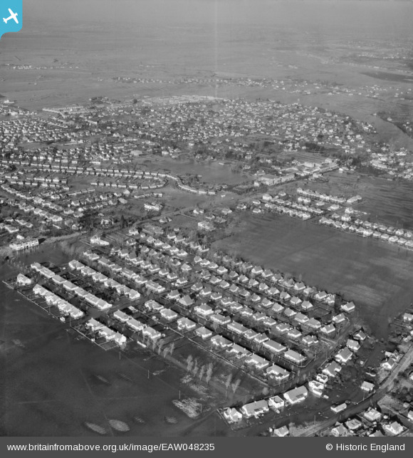
EAW048235 ENGLAND (1953). Flooded housing around Furtherwick Road and St George's Field, Canvey Island, from the south-east, 1953
© Hawlfraint cyfranwyr OpenStreetMap a thrwyddedwyd gan yr OpenStreetMap Foundation. 2026. Trwyddedir y gartograffeg fel CC BY-SA.
Delweddau cyfagos (8)
EAW048235

EAW045301

EAW045302

EAW026918

EAW045303

EAW045329

EAW026917

EAW045300

Manylion
| Pennawd | [EAW048235] Flooded housing around Furtherwick Road and St George's Field, Canvey Island, from the south-east, 1953 |
| Cyfeirnod | EAW048235 |
| Dyddiad | 2-February-1953 |
| Dolen | |
| Enw lle | CANVEY ISLAND |
| Plwyf | CANVEY ISLAND |
| Ardal | |
| Gwlad | ENGLAND |
| Dwyreiniad / Gogleddiad | 580346, 182840 |
| Hydred / Lledred | 0.59948155552851, 51.515171256789 |
| Cyfeirnod Grid Cenedlaethol | TQ803828 |
Pinnau

ArtfulCopy |
Wednesday 15th of October 2025 08:23:11 PM |