
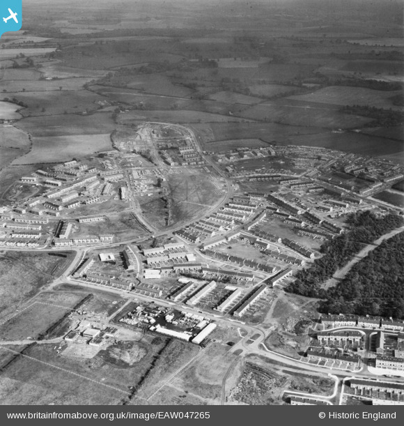
EAW047265 ENGLAND (1952). The residential areas at Whomerley Wood and Bedwell North under construction, Bedwell, from the south-west, 1952
© Hawlfraint cyfranwyr OpenStreetMap a thrwyddedwyd gan yr OpenStreetMap Foundation. 2026. Trwyddedir y gartograffeg fel CC BY-SA.
Delweddau cyfagos (11)
EAW047265

EAW047263

EAW047262

EAW041980

EAW047260

EAW053198

EAW053196

EAW053197

EAW047261

EAW041985

EAW032037

Manylion
| Pennawd | [EAW047265] The residential areas at Whomerley Wood and Bedwell North under construction, Bedwell, from the south-west, 1952 |
| Cyfeirnod | EAW047265 |
| Dyddiad | 15-October-1952 |
| Dolen | |
| Enw lle | BEDWELL |
| Plwyf | |
| Ardal | |
| Gwlad | ENGLAND |
| Dwyreiniad / Gogleddiad | 524492, 223974 |
| Hydred / Lledred | -0.19036962700109, 51.899947559873 |
| Cyfeirnod Grid Cenedlaethol | TL245240 |
Pinnau
Byddwch y cyntaf i ychwanegu sylw at y ddelwedd hon!