
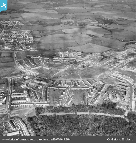
EAW047264 ENGLAND (1952). The residential areas at Whomerley Wood and Bedwell North under construction, Bedwell, 1952
© Hawlfraint cyfranwyr OpenStreetMap a thrwyddedwyd gan yr OpenStreetMap Foundation. 2026. Trwyddedir y gartograffeg fel CC BY-SA.
Delweddau cyfagos (5)
EAW047264

EAW053197

EAW053196

EAW053198

EAW047260

Manylion
| Pennawd | [EAW047264] The residential areas at Whomerley Wood and Bedwell North under construction, Bedwell, 1952 |
| Cyfeirnod | EAW047264 |
| Dyddiad | 15-October-1952 |
| Dolen | |
| Enw lle | BEDWELL |
| Plwyf | |
| Ardal | |
| Gwlad | ENGLAND |
| Dwyreiniad / Gogleddiad | 524678, 224274 |
| Hydred / Lledred | -0.18755883448479, 51.902602183418 |
| Cyfeirnod Grid Cenedlaethol | TL247243 |
Pinnau
Byddwch y cyntaf i ychwanegu sylw at y ddelwedd hon!