
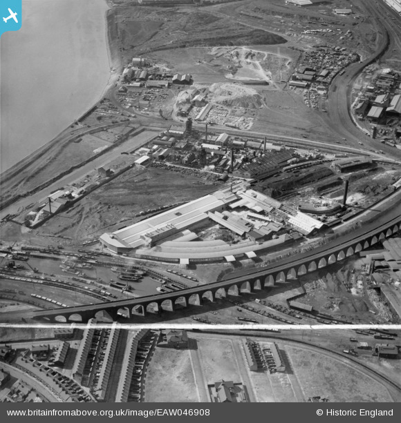
EAW046908 ENGLAND (1952). Fisons Ltd Works at the West Bank Dock Estate and the railway viaduct, Widnes, 1952. This image was marked by Aerofilms Ltd for photo editing.
© Hawlfraint cyfranwyr OpenStreetMap a thrwyddedwyd gan yr OpenStreetMap Foundation. 2026. Trwyddedir y gartograffeg fel CC BY-SA.
Delweddau cyfagos (16)
EAW046908

EPW024956

EPW024958

EPW024951

EAW046905

EPW024955

EPW024957

EPW024952

EAW046907

EAW046906

EPW024954

EAW046904

EAW046909

EAW046910

EPW024953

EAW046912

Manylion
| Pennawd | [EAW046908] Fisons Ltd Works at the West Bank Dock Estate and the railway viaduct, Widnes, 1952. This image was marked by Aerofilms Ltd for photo editing. |
| Cyfeirnod | EAW046908 |
| Dyddiad | September-1952 |
| Dolen | |
| Enw lle | WIDNES |
| Plwyf | |
| Ardal | |
| Gwlad | ENGLAND |
| Dwyreiniad / Gogleddiad | 350727, 384208 |
| Hydred / Lledred | -2.7403234207536, 53.352192576735 |
| Cyfeirnod Grid Cenedlaethol | SJ507842 |
Pinnau

Bottom Yard |
Sunday 13th of October 2024 04:31:37 PM | |

Ginger79 |
Monday 8th of March 2021 08:14:44 PM | |
|
redmist |
Thursday 23rd of July 2020 08:57:44 PM | |
|
redmist |
Thursday 23rd of July 2020 08:56:31 PM | |
|
redmist |
Thursday 28th of March 2019 12:52:42 AM |