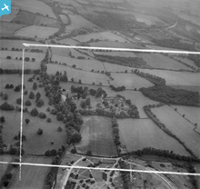
EAW046821 ENGLAND (1952). Sherfield Hall and surrounding countryside, Sherfield on Loddon, 1952. This image was marked by Aerofilms Ltd for photo editing.

© Hawlfraint cyfranwyr OpenStreetMap a thrwyddedwyd gan yr OpenStreetMap Foundation. 2026. Trwyddedir y gartograffeg fel CC BY-SA.
Delweddau cyfagos (9)
EAW046821

EAW046822

EAW046171

EAW046169

EAW046173

EAW046172

EAW046826

EAW046174

EAW046170

Manylion
| Pennawd | [EAW046821] Sherfield Hall and surrounding countryside, Sherfield on Loddon, 1952. This image was marked by Aerofilms Ltd for photo editing. |
| Cyfeirnod | EAW046821 |
| Dyddiad | September-1952 |
| Dolen | |
| Enw lle | SHERFIELD ON LODDON |
| Plwyf | SHERFIELD ON LODDON |
| Ardal | |
| Gwlad | ENGLAND |
| Dwyreiniad / Gogleddiad | 466664, 156013 |
| Hydred / Lledred | -1.0437023159933, 51.298827864715 |
| Cyfeirnod Grid Cenedlaethol | SU667560 |
Pinnau

John W |
Saturday 29th of July 2023 07:22:38 PM | |

Matt Aldred edob.mattaldred.com |
Monday 8th of March 2021 12:17:07 PM | |
|
jrussill |
Tuesday 14th of October 2014 02:21:39 PM |