
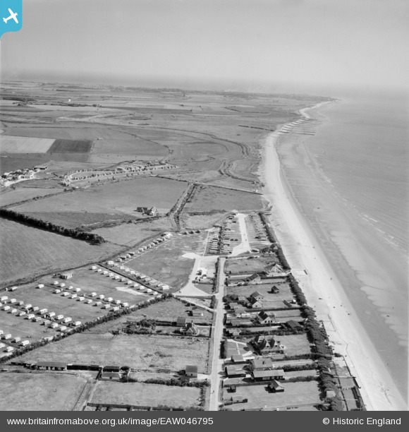
EAW046795 ENGLAND (1952). East Bracklesham Drive, the Redskin Caravan Co Ltd Caravan Park at Bracklesham Bay and environs, Bracklesham, from the north-west, 1952
© Hawlfraint cyfranwyr OpenStreetMap a thrwyddedwyd gan yr OpenStreetMap Foundation. 2026. Trwyddedir y gartograffeg fel CC BY-SA.
Delweddau cyfagos (17)
EAW046795

EAW046954

EAW046957

EAW046792

EAW046793

EAW046796

EAW046950

EAW046953

EAW046956

EAW046789

EAW046951

EAW046790

EAW046787

EAW046788

EAW046791

EAW046949

EAW046948

Manylion
| Pennawd | [EAW046795] East Bracklesham Drive, the Redskin Caravan Co Ltd Caravan Park at Bracklesham Bay and environs, Bracklesham, from the north-west, 1952 |
| Cyfeirnod | EAW046795 |
| Dyddiad | 16-September-1952 |
| Dolen | |
| Enw lle | BRACKLESHAM |
| Plwyf | EAST WITTERING |
| Ardal | |
| Gwlad | ENGLAND |
| Dwyreiniad / Gogleddiad | 481412, 95851 |
| Hydred / Lledred | -0.84570005749422, 50.755969535557 |
| Cyfeirnod Grid Cenedlaethol | SZ814959 |
Pinnau
Byddwch y cyntaf i ychwanegu sylw at y ddelwedd hon!