
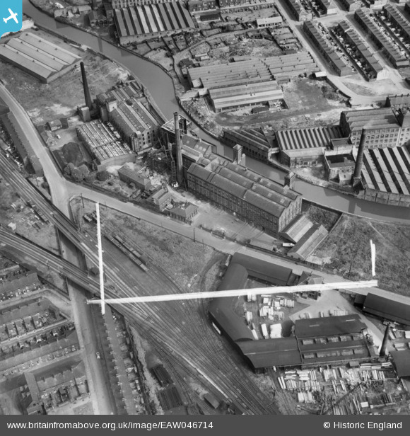
EAW046714 ENGLAND (1952). Daisyfield Mills, Appleby Street and environs, Blackburn, 1952. This image was marked by Aerofilms Ltd for photo editing.
© Hawlfraint cyfranwyr OpenStreetMap a thrwyddedwyd gan yr OpenStreetMap Foundation. 2026. Trwyddedir y gartograffeg fel CC BY-SA.
Delweddau cyfagos (10)
EAW046714

EAW046716

EAW046712

EAW046713

EAW046715

EAW046709

EAW046707

EAW046708

EAW046711

EAW046710

Manylion
| Pennawd | [EAW046714] Daisyfield Mills, Appleby Street and environs, Blackburn, 1952. This image was marked by Aerofilms Ltd for photo editing. |
| Cyfeirnod | EAW046714 |
| Dyddiad | 7-September-1952 |
| Dolen | |
| Enw lle | BLACKBURN |
| Plwyf | |
| Ardal | |
| Gwlad | ENGLAND |
| Dwyreiniad / Gogleddiad | 369327, 428514 |
| Hydred / Lledred | -2.4652206357984, 53.751869381127 |
| Cyfeirnod Grid Cenedlaethol | SD693285 |
