
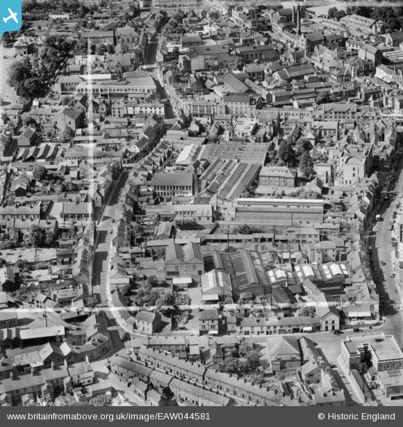
EAW044581 ENGLAND (1952). The William Cotton Ltd Knitting Machine Factory on Pinfold Gate and the town centre, Loughborough, 1952. This image was marked by Aerofilms Ltd for photo editing.
© Hawlfraint cyfranwyr OpenStreetMap a thrwyddedwyd gan yr OpenStreetMap Foundation. 2026. Trwyddedir y gartograffeg fel CC BY-SA.
Delweddau cyfagos (10)
EAW044581

EAW044578

EAW044580

EAW044576

EAW044575

EAW044577

EPW057738

EAW044574

EAW044579

EPW057732

Manylion
| Pennawd | [EAW044581] The William Cotton Ltd Knitting Machine Factory on Pinfold Gate and the town centre, Loughborough, 1952. This image was marked by Aerofilms Ltd for photo editing. |
| Cyfeirnod | EAW044581 |
| Dyddiad | 15-July-1952 |
| Dolen | |
| Enw lle | LOUGHBOROUGH |
| Plwyf | |
| Ardal | |
| Gwlad | ENGLAND |
| Dwyreiniad / Gogleddiad | 453876, 319649 |
| Hydred / Lledred | -1.2013306818253, 52.771407338548 |
| Cyfeirnod Grid Cenedlaethol | SK539196 |
Pinnau

Grudge |
Monday 5th of November 2018 01:51:53 PM |