
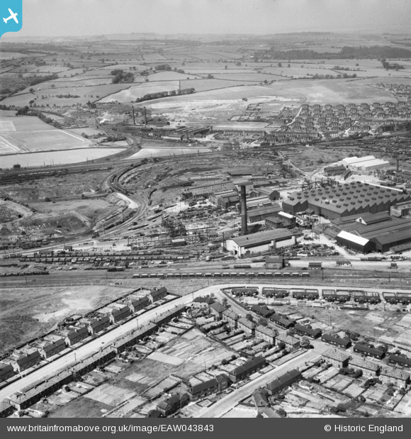
EAW043843 ENGLAND (1952). The Staveley Iron Works, Staveley, from the south, 1952
© Hawlfraint cyfranwyr OpenStreetMap a thrwyddedwyd gan yr OpenStreetMap Foundation. 2026. Trwyddedir y gartograffeg fel CC BY-SA.
Delweddau cyfagos (6)
EAW043843

EAW003059

EAW043844

EAW003072

EPW041667

EPW041672

Manylion
| Pennawd | [EAW043843] The Staveley Iron Works, Staveley, from the south, 1952 |
| Cyfeirnod | EAW043843 |
| Dyddiad | 10-June-1952 |
| Dolen | |
| Enw lle | STAVELEY |
| Plwyf | STAVELEY |
| Ardal | |
| Gwlad | ENGLAND |
| Dwyreiniad / Gogleddiad | 441255, 374618 |
| Hydred / Lledred | -1.3813854693296, 53.266672354288 |
| Cyfeirnod Grid Cenedlaethol | SK413746 |
Pinnau
Byddwch y cyntaf i ychwanegu sylw at y ddelwedd hon!