
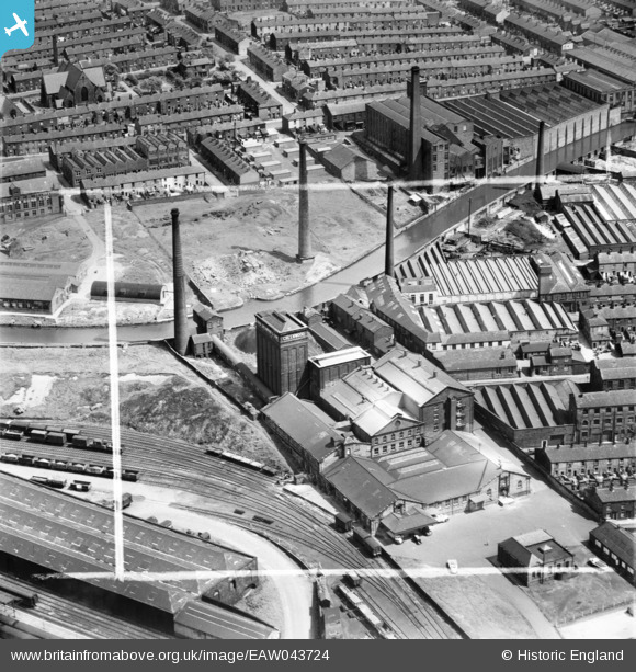
EAW043724 ENGLAND (1952). John Greenwood and Sons Flour Mill beside the Goods Shed and Goods Yard, Blackburn, 1952. This image was marked by Aerofilms Ltd for photo editing.
© Hawlfraint cyfranwyr OpenStreetMap a thrwyddedwyd gan yr OpenStreetMap Foundation. 2026. Trwyddedir y gartograffeg fel CC BY-SA.
Delweddau cyfagos (11)
EAW043724

EAW043726

EAW043723

EAW043727

EAW043725

EAW043729

EAW043728

EPW005012

EPW013922

EPW013926

EPW005014

Manylion
| Pennawd | [EAW043724] John Greenwood and Sons Flour Mill beside the Goods Shed and Goods Yard, Blackburn, 1952. This image was marked by Aerofilms Ltd for photo editing. |
| Cyfeirnod | EAW043724 |
| Dyddiad | 5-June-1952 |
| Dolen | |
| Enw lle | BLACKBURN |
| Plwyf | |
| Ardal | |
| Gwlad | ENGLAND |
| Dwyreiniad / Gogleddiad | 368595, 427722 |
| Hydred / Lledred | -2.4762420221941, 53.744706669012 |
| Cyfeirnod Grid Cenedlaethol | SD686277 |
Pinnau

powerpop |
Tuesday 28th of October 2014 09:04:26 PM |