
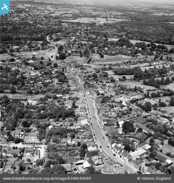
EAW043699 ENGLAND (1952). The High Street and town, Billericay, from the south-west, 1952
© Hawlfraint cyfranwyr OpenStreetMap a thrwyddedwyd gan yr OpenStreetMap Foundation. 2025. Trwyddedir y gartograffeg fel CC BY-SA.
Delweddau cyfagos (4)
EAW043699

EAW043700

EAW043702

EPW022338

Manylion
| Pennawd | [EAW043699] The High Street and town, Billericay, from the south-west, 1952 |
| Cyfeirnod | EAW043699 |
| Dyddiad | 4-June-1952 |
| Dolen | |
| Enw lle | BILLERICAY |
| Plwyf | BILLERICAY |
| Ardal | |
| Gwlad | ENGLAND |
| Dwyreiniad / Gogleddiad | 567363, 194517 |
| Hydred / Lledred | 0.41809487124153, 51.624078088501 |
| Cyfeirnod Grid Cenedlaethol | TQ674945 |
Pinnau

SpongeLab |
Saturday 6th of January 2024 01:41:06 AM | |

Class31 |
Friday 27th of February 2015 10:50:39 PM | |
|
Whiskas42 |
Monday 5th of January 2015 01:06:19 AM | |
|
Rod |
Thursday 1st of January 2015 10:08:31 PM | |
|
Bisto |
Monday 17th of November 2014 02:14:04 PM | |
|
Bisto |
Monday 17th of November 2014 02:13:47 PM |