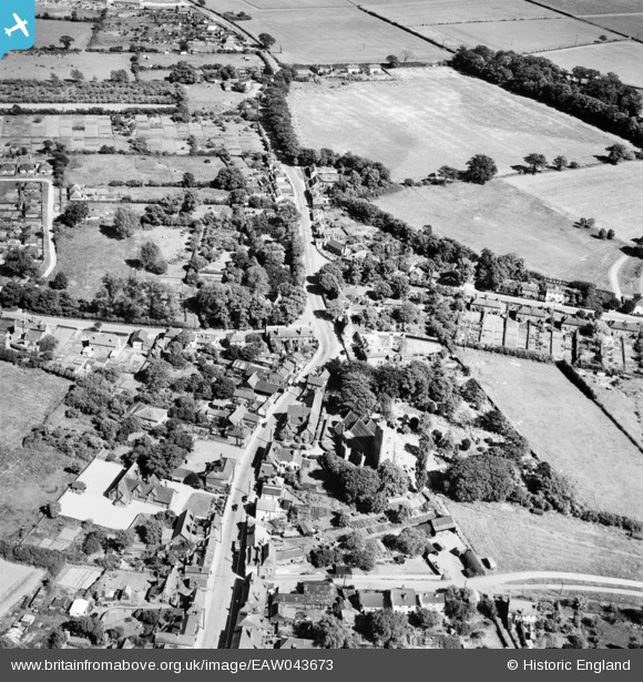
EAW043673 ENGLAND (1952). The village, Thorpe-le-Soken, 1952
© Hawlfraint cyfranwyr OpenStreetMap a thrwyddedwyd gan yr OpenStreetMap Foundation. 2026. Trwyddedir y gartograffeg fel CC BY-SA.
Manylion
| Pennawd | [EAW043673] The village, Thorpe-le-Soken, 1952 |
| Cyfeirnod | EAW043673 |
| Dyddiad | 4-June-1952 |
| Dolen | |
| Enw lle | THORPE-LE-SOKEN |
| Plwyf | THORPE-LE-SOKEN |
| Ardal | |
| Gwlad | ENGLAND |
| Dwyreiniad / Gogleddiad | 618035, 222266 |
| Hydred / Lledred | 1.1665413734765, 51.855875878719 |
| Cyfeirnod Grid Cenedlaethol | TM180223 |
Pinnau

totoro |
Monday 26th of December 2016 09:50:27 PM | |

totoro |
Monday 26th of December 2016 09:47:08 PM | |

totoro |
Monday 26th of December 2016 09:46:43 PM | |

totoro |
Monday 26th of December 2016 09:43:08 PM | |

totoro |
Monday 26th of December 2016 09:35:27 PM | |

totoro |
Monday 26th of December 2016 09:33:16 PM | |

totoro |
Monday 26th of December 2016 09:29:37 PM | |

totoro |
Monday 26th of December 2016 09:28:32 PM | |

totoro |
Monday 26th of December 2016 09:28:03 PM |


![[EAW043673] The village, Thorpe-le-Soken, 1952](http://britainfromabove.org.uk/sites/all/libraries/aerofilms-images/public/100x100/EAW/043/EAW043673.jpg)
![[EAW043674] The village, Thorpe-le-Soken, 1952](http://britainfromabove.org.uk/sites/all/libraries/aerofilms-images/public/100x100/EAW/043/EAW043674.jpg)
![[EAW043675] The village, Thorpe-le-Soken, 1952](http://britainfromabove.org.uk/sites/all/libraries/aerofilms-images/public/100x100/EAW/043/EAW043675.jpg)