
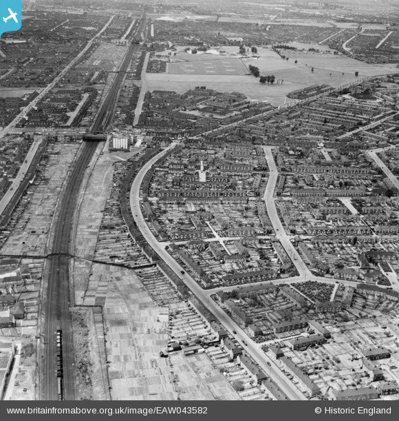
EAW043582 ENGLAND (1952). Reede Road and environs, Dagenham, from the east, 1952
© Hawlfraint cyfranwyr OpenStreetMap a thrwyddedwyd gan yr OpenStreetMap Foundation. 2025. Trwyddedir y gartograffeg fel CC BY-SA.
Delweddau cyfagos (2)
EAW043582

EPW017651

Manylion
| Pennawd | [EAW043582] Reede Road and environs, Dagenham, from the east, 1952 |
| Cyfeirnod | EAW043582 |
| Dyddiad | 4-June-1952 |
| Dolen | |
| Enw lle | DAGENHAM |
| Plwyf | |
| Ardal | |
| Gwlad | ENGLAND |
| Dwyreiniad / Gogleddiad | 549592, 184936 |
| Hydred / Lledred | 0.1574608734337, 51.54298896044 |
| Cyfeirnod Grid Cenedlaethol | TQ496849 |
Pinnau

John Wass |
Tuesday 23rd of June 2015 10:17:50 PM | |
this is dagenham heathway |
henry |
Sunday 28th of June 2015 07:58:40 PM |
I believe that the two stations are Dagenham Heathway (in the foreground, the Odeon? Cinema is to the right) and Becontree beyond Parsloes Park. I lived in Heathway (the Chequers end) From 1949 to 1972). |
Ken Stanton |
Monday 8th of July 2019 11:44:40 AM |
|
John Wass |
Tuesday 23rd of June 2015 10:15:34 PM | |
this is beacontree |
henry |
Sunday 28th of June 2015 07:59:20 PM |