
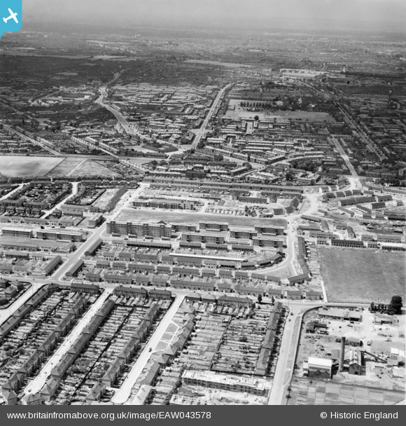
EAW043578 ENGLAND (1952). Part of the Becontree Estate centred upon Listowel Road, Dagenham, from the east, 1952
© Hawlfraint cyfranwyr OpenStreetMap a thrwyddedwyd gan yr OpenStreetMap Foundation. 2026. Trwyddedir y gartograffeg fel CC BY-SA.
Delweddau cyfagos (3)
EAW043578

EAW043577

EPW046202

Manylion
| Pennawd | [EAW043578] Part of the Becontree Estate centred upon Listowel Road, Dagenham, from the east, 1952 |
| Cyfeirnod | EAW043578 |
| Dyddiad | 4-June-1952 |
| Dolen | |
| Enw lle | DAGENHAM |
| Plwyf | |
| Ardal | |
| Gwlad | ENGLAND |
| Dwyreiniad / Gogleddiad | 549496, 186387 |
| Hydred / Lledred | 0.15669410408701, 51.556053169349 |
| Cyfeirnod Grid Cenedlaethol | TQ495864 |
Pinnau
Byddwch y cyntaf i ychwanegu sylw at y ddelwedd hon!