
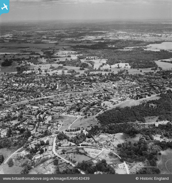
EAW043439 ENGLAND (1952). The landscape towards Denham and the valley of the River Colne, Gerrard's Cross, from the south-west, 1952
© Hawlfraint cyfranwyr OpenStreetMap a thrwyddedwyd gan yr OpenStreetMap Foundation. 2026. Trwyddedir y gartograffeg fel CC BY-SA.
Delweddau cyfagos (3)
EAW043439

EPW005689

EPW005683

Manylion
| Pennawd | [EAW043439] The landscape towards Denham and the valley of the River Colne, Gerrard's Cross, from the south-west, 1952 |
| Cyfeirnod | EAW043439 |
| Dyddiad | 28-May-1952 |
| Dolen | |
| Enw lle | GERRARD'S CROSS |
| Plwyf | GERRARDS CROSS |
| Ardal | |
| Gwlad | ENGLAND |
| Dwyreiniad / Gogleddiad | 499754, 188543 |
| Hydred / Lledred | -0.55998861418999, 51.586427933898 |
| Cyfeirnod Grid Cenedlaethol | SU998885 |
Pinnau

Ferrers |
Friday 25th of December 2020 05:52:04 PM | |

moses72 |
Sunday 4th of January 2015 02:22:20 PM | |
|
moses72 |
Sunday 4th of January 2015 02:21:15 PM | |
|
moses72 |
Sunday 4th of January 2015 02:20:24 PM | |
|
moses72 |
Sunday 4th of January 2015 02:13:31 PM | |
|
moses72 |
Sunday 4th of January 2015 02:12:33 PM | |
|
moses72 |
Sunday 4th of January 2015 02:11:35 PM | |
|
moses72 |
Sunday 4th of January 2015 02:10:45 PM | |
|
moses72 |
Sunday 4th of January 2015 02:09:45 PM | |
|
moses72 |
Sunday 4th of January 2015 02:09:03 PM |